| << Portugal: Amtliche topografische Landkarten des Instituto Geográfico do Exército (IGeoE) 1:25.000 (Serie M888) |
||
|
||

Zuletzt angesehene Artikel:
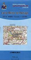
 | 335 Castelo de Vide Topographische Landkarte Portugal 1:25.000 Carta Militar de Portugal - Série M888 Instituto Geográfico do Exército (IGeoE) - Portugal |
 | 28M PAJALA 1:100.000 *** SCHNÃPPCHEN *** Wegekarte Schweden (Vägkarta/BlÃ¥ Kartan) - Kartförlaget - Lantmäteriet Landkarte Schweden |
 | 4206 (NL 33-02-06) Pernitz Topographische Wanderkarte 1:50.000 mit Wegmarkierungen - Ãsterreich - Kartographie BEV - ProjektNord |
 | Maremma - Touristische Wanderkarte 1:100.000 (Blatt 904) Carta Turistica e dei Sentieri - Edizioni Multigraphic - Italien |
 | 3247 Biesenthal Sonderausgabe mit Wanderwegen - Topographische Wanderkarte Brandenburg 1:25.000 ProjektNord |
 | Climbing in Athens Δημητρης Τιτοπουλος Αναρριχηση διπλα στο σπιτι σας Anavasi - Griechenland |
 | 3248 Melchow Sonderausgabe mit Wanderwegen - Topographische Wanderkarte Brandenburg 1:25.000 ProjektNord |
 | 3244 Kremmen Sonderausgabe mit Wanderwegen - Topographische Wanderkarte Brandenburg 1:25.000 ProjektNord |
 | 3146 Liebenwalde Sonderausgabe mit Wanderwegen - Topographische Wanderkarte Brandenburg 1:25.000 ProjektNord |
 | 3217 (NL 33-01-17) Hallstatt Topographische Wanderkarte 1:50.000 mit Wegmarkierungen - Ãsterreich - Kartographie BEV - ProjektNord |
 | 3542 Groà Kreutz Sonderausgabe mit Wanderwegen - Topographische Wanderkarte Brandenburg 1:25.000 ProjektNord |
 | P5141 Muuruvesi Topographische Karte 1:25.000 EUREF (Peruskartta) Maanmittauslaitos / Lantmäteriverket Finnland - ProjektNord |
| 3162 Kreuz Topographische Karte 1:25.000 Messtischblatt des Deutschen Reiches - PreuÃische Landesaufnahme / Reichsamt für Landesaufnahme - Faksimile ProjektNord |
 | Paddeln 3: Mecklenburgische Kleinseenplatte bis Feldberg (Bernhard Horn) - Grünes Herz |
 | Nationalpark Hohe Tauern Süd 1:50.000 (Blatt 49) - Wanderkarte mit Broschüre *** SCHNÃPPCHEN *** KOMPASS |
 | Mosel.Erlebnis.Route (MPK) - Wandern, Radwandern und Wasserwandern im Moselland von Koblenz bis Perl Topografische Freizeitkarte 1:50.000 - Landesamt für Vermessung und Geobasisinformation Rheinland-Pfalz |
 | Parco Nazionale Gran Paradiso - Valle d`Aosta - Valle dell`Orco (Nr. 86) *** SCHNÃPPCHEN *** Wanderkarte mit Radrouten und alpinen Skirouten. GPS-genau. 1:50000. KOMPASS-Karten |
 | 3050 Lunow Sonderausgabe mit Wanderwegen - Topographische Wanderkarte Brandenburg 1:25.000 ProjektNord |
 | Mittleres Pilitza-Tal Wanderkarte 1:75.000 Wasserfeste Landkarte, Wanderkarte, Kanurouten Dolina Środkowej Pilicy Compass - Polen |
 | 3450 Müncheberg Sonderausgabe mit Wanderwegen - Topographische Wanderkarte Brandenburg 1:25.000 ProjektNord |