| << Portugal: Amtliche topografische Landkarten des Instituto Geográfico do Exército (IGeoE) 1:25.000 (Serie M888) |
||
|
||

Zuletzt angesehene Artikel:
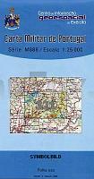
 | 321 - Topographische Landkarte Portugal 1:25.000 Carta Militar de Portugal - Série M888 Instituto Geográfico do Exército (IGeoE) - Portugal |
 | Panorama der Hohen Tatra Laminierte Panoramakarte Panorama Tatr laminowana PLAN Galileos - Polen |
 | Cottbus 1:75.000 Pocket Fahrradkarte -Forst, Spremberg, Lübben, Peitz : mit Fürst-Pückler-Tour - von Sherpa, Eva - grünes herz |
 | Palästinensisch-Syrisch-Arabisch - Wort für Wort Kauderwelsch-Sprachführer (Band 075) Reise-Know-How Verlag |
 | Panama The premier guidebook for Business Globetrotters (englisch) Nigeria eBiz Guides |
 | 367 - Topographische Landkarte Portugal 1:25.000 Carta Militar de Portugal - Série M888 Instituto Geográfico do Exército (IGeoE) - Portugal |
 | 2227 (NL 32-03-27) Längenfeld Topographische Wanderkarte 1:50.000 mit Wegmarkierungen - Ãsterreich - Kartographie BEV - ProjektNord |
 | 13/24 Lel`chitsy / Pershotravnevoie - Amtliche topographische Landkarte 1:100.000 der Ukraine Kiewskaja Wojenno-Kartografitscheskaja Fabrika Ukraine |
 | N5211 Pieksämäki Topographische Karte 1:25.000 EUREF (Peruskartta) Maanmittauslaitos / Lantmäteriverket Finnland - ProjektNord |
 | Loire à pied - Roannais, Forez, Lyonnais, Pilat - Réf. D042 Topographischer Wanderführer - FFRP (Fédération française de randonnée pédestre) Frankreich |
 | Region Mecklenburgische Seenplatte (West) 1:200.000 Topographische StraÃenkarte ProjektNord - Bundesamt f. Kartographie u. Geodäsie |
 | 3243 Linum Sonderausgabe mit Wanderwegen - Topographische Wanderkarte Brandenburg 1:25.000 ProjektNord |
 | 3452 Seelow Sonderausgabe mit Wanderwegen - Topographische Wanderkarte Brandenburg 1:25.000 ProjektNord |
 | T4312 Petäjäinen Topographische Karte 1:25.000 EUREF (Peruskartta) Maanmittauslaitos / Lantmäteriverket Finnland - ProjektNord |
 | 402 Parco Naturale Regionale di Bracciano - Martignano 1:25.000 4land Carta Topografica Escursionistica 4land |
 | British Columbia Reiseatlas StraÃenatlas Kanada - GM Johnson Map Book Series Britisch Columbia Map book |
| Provinz Luxemburg Nord (Belgien) - Knotenpunkte NGI 1:50.000 Fahrradkarte Belgien Réseaux Points-N?uds de la Province de Luxembourg carte Nord / Fietsknooppuntennetwerk Provincie Luxemburg Kaart Noord NGI Belgien |
 | Wandern auf dem Roslagsleden - Wanderführer (schwedisch) Vandra Roslagsleden Calazo Förlag |
 | Maremma - Grosseto - Monte Argentario - Isola del Giglio - Parco Regionale della Maremma - Parco Naturale dell` Uccellina (Nr. 2470) Wanderkarte mit Radtouren. GPS-genau. 1:50.000 KOMPASS-Karten |
 | 3223 Hodenhagen Amtliche topographische Karte 1:25.000 Landesvermessungsamt Niedersachsen |