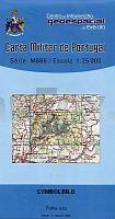
| << Portugal: Amtliche topografische Landkarten des Instituto Geográfico do Exército (IGeoE) 1:25.000 (Serie M888) |
||
|
||

Zuletzt angesehene Artikel:
 | 314 - Topographische Landkarte Portugal 1:25.000 Carta Militar de Portugal - Série M888 Instituto Geográfico do Exército (IGeoE) - Portugal |
 | Spardose Koffer Vintage Landkarte Sass & Belle |
 | 358 - Topographische Landkarte Portugal 1:25.000 Carta Militar de Portugal - Série M888 Instituto Geográfico do Exército (IGeoE) - Portugal |
 | 309 Ourém -Topographische Landkarte Portugal 1:25.000 Carta Militar de Portugal - Série M888 Instituto Geográfico do Exército (IGeoE) - Portugal |
 | Gorce und Pieninen 1:52.000 Laminierte touristische Landkarte - ExpressMap Gorce i Pieniny. Mapa panoramiczna ExpressMap Polen |
 | 3340-SO Topographische Karte 1:10.000 - Landesvermessungsamt Brandenburg |
| 3545-NW Topographische Karte 1:10.000 - Landesvermessungsamt Brandenburg |
 | 397 (13-16) Zamora Sur Amtliche topographische Landkarte 1:50.000 Spanien (M.T.N.) 397 Mapa Topográfico Nacional de Espana (MTN50) Instituto Geográfico Nacional - CNIG Spanien |
 | 6238 Parkstein Topographische Landkarte Bayern 1:25.000 - Normalausgabe - ProjektNord (geplottete Ausgabe) - Grundlage amtliche Topographische Karte Bayern DTK25 |
 | 391 - Topographische Landkarte Portugal 1:25.000 Carta Militar de Portugal - Série M888 Instituto Geográfico do Exército (IGeoE) - Portugal |
 | Pardubitz - Chrudim + Umgebung 1:12.000 / 1:100.000 *** SCHNÃPPCHEN *** Stadtplan m. festem Deckel Pardubice - Chrudim a okolà SHOCart Tschechien |
 | 304 - Topographische Landkarte Portugal 1:25.000 Carta Militar de Portugal - Série M888 Instituto Geográfico do Exército (IGeoE) - Portugal |
 | 3342 Paulinenaue Sonderausgabe mit Wanderwegen - Topographische Wanderkarte Brandenburg 1:25.000 ProjektNord |
 | 346 - Topographische Landkarte Portugal 1:25.000 Carta Militar de Portugal - Série M888 Instituto Geográfico do Exército (IGeoE) - Portugal |
 | 329 - Topographische Landkarte Portugal 1:25.000 Carta Militar de Portugal - Série M888 Instituto Geográfico do Exército (IGeoE) - Portugal |
 | 3530 Wolfsburg Topographische Wanderkarte 1:25.000 Niedersachsen mit Wanderwegen - ProjektNord |
| 3552-NO Topographische Karte 1:10.000 - Landesvermessungsamt Brandenburg |
| 3449-SO Topographische Karte 1:10.000 - Landesvermessungsamt Brandenburg |
| 3044-SO Topographische Karte 1:10.000 - Landesvermessungsamt Brandenburg |
 | 377 - Topographische Landkarte Portugal 1:25.000 Carta Militar de Portugal - Série M888 Instituto Geográfico do Exército (IGeoE) - Portugal |