| << Portugal: Amtliche topografische Landkarten des Instituto Geográfico do Exército (IGeoE) 1:25.000 (Serie M888) |
||
|
||

Zuletzt angesehene Artikel:
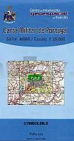
 | 303 - Topographische Landkarte Portugal 1:25.000 Carta Militar de Portugal - Série M888 Instituto Geográfico do Exército (IGeoE) - Portugal |
 | Peak Bagging: Wainwrights Vertebrate Publishing |
 | L4318 Paderborn (geplottete Ausgabe) Amtliche topographische Karte 1:50.000 Landesvermessungsamt Nordrhein-Westfalen |
 | 7040 Pfatter Topographische Landkarte Bayern 1:25.000 - Normalausgabe - ProjektNord (geplottete Ausgabe) - Grundlage amtliche Topographische Karte Bayern DTK25 |
 | 31 S. Miguel (Arrifes - Azoren) - Topografische Karte Portugal 1:25.000 Carta Militar de Portugal - Série M889 - 1/25 000 (Acores) - Instituto Geográfico do Exército (IGeoE) - Portugal |
 | P542 Nurmes Topographische Karte 1:50.000 EUREF-FIN (Maastokarttat) Maanmittauslaitos / Lantmäteriverket Finnland - ProjektNord |
 | 3540 Havel - Plaue Sonderausgabe mit Wanderwegen - Topographische Wanderkarte Brandenburg 1:25.000 ProjektNord |
 | 322 Wetterstein - Karwendel - Seefeld - Leutasch - Garmisch Partenkirchen 1:50.000 - Wanderkarte / Radwanderkarte / Wintersportkarte Ãsterreich - GPS - Freytag & Berndt |
 | 3553 Lebus Sonderausgabe mit Wanderwegen - Topographische Wanderkarte Brandenburg 1:25.000 ProjektNord |
 | 301 Laguna di Grado - Aquileia - Palmanova 1:25.000 Rad- Wander- und Gewässerkarte - Casa Editrice Tabacco - Italien |
 | 30 Wanderungen Schwarzwald OutdoorHandbuch (Band 383) von Janina Meier - Conrad-Stein-Verlag |
 | Pylea Messinia (Blatt 402) Regionale Wanderkarte 1:90.000 Orama - Griechenland Πυλία Μεσσηνίας - Pylea of Messenia |
| 322.33 Amtliche topographische Karte 1:25.000 Polen |
 | P5143 Kaavi Topographische Karte 1:25.000 EUREF (Peruskartta) Maanmittauslaitos / Lantmäteriverket Finnland - ProjektNord |
 | Ost-Aserbaidschan - Touristische Landkarte - Provinz-StraÃenkarte 1:500.000 (Blatt 183) Landkarte / StraÃenkarte (englisch) The Tourism Map of Azarbayejan-e Sharqi - آخربايجان شرقی Iranshenasi - Iran |
 | Wester Ross & Lochalsh - 40 Wanderungen entlang der Küste und auf dem Land Englischsprachiger Wanderführer - Paul and Helen Webster - POCKET MOUNTAINS LTD Wester Ross & Lochalsh - 40 Coast & Country Walks |
 | Mittleres Pilitza-Tal Wanderkarte 1:75.000 Wanderkarte, Kanurouten Dolina Środkowej Pilicy mapa Compass - Polen |
 | 3626 Hämelerwald Amtliche topographische Karte 1:25.000 Landesvermessungsamt Niedersachsen |
 | 3541 Brandenburg a. d. Havel Sonderausgabe mit Wanderwegen - Topographische Wanderkarte Brandenburg 1:25.000 ProjektNord |
 | Mainalo (Blatt 8.5) Topografische Bergwanderkarte Peloponnes - Griechenland 1:50.000 - Peloponnese Mainalo / Mt. Menalo - Μαιναλο - Anavasi - Griechenland |