| << Portugal: Amtliche topografische Landkarten des Instituto Geográfico do Exército (IGeoE) 1:25.000 (Serie M888) |
||
|
||

Zuletzt angesehene Artikel:
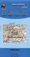
 | 279 Salgueiro Do Campo (Castelo Branco) - Topographische Landkarte Portugal 1:25.000 Carta Militar de Portugal - Série M888 Instituto Geográfico do Exército (IGeoE) - Portugal |
 | 2029 Stockelsdorf - Gestern und Heute - Historische Ãberlagerung 1902-1930 Topographische Landkarte 1:25.000 im Vergleich - Landesvermessungsamt Schleswig-Holstein / ProjektNord |
 | 205-IV (48-20) San Adrián Amtliche topographische Landkarte 1:25.000 Spanien (M.T.N.) 205-IV Mapa Topográfico Nacional de Espana (MTN25) Instituto Geográfico Nacional - CNIG Spanien |
 | 241-3 ORTIGOSA DE CAMEROS Amtliche topographische Landkarte 1:25.000 Spanien (M.T.N.) 241-3 Mapa Topográfico Nacional de Espana (MTN25) Instituto Geográfico Nacional - CNIG Spanien |
 | 272-2 HERRIN DE CAMPOS Amtliche topographische Landkarte 1:25.000 Spanien (M.T.N.) 272-2 Mapa Topográfico Nacional de Espana (MTN25) Instituto Geográfico Nacional - CNIG Spanien |
 | 295-3 AMER Amtliche topographische Landkarte 1:25.000 Spanien (M.T.N.) 295-3 Mapa Topográfico Nacional de Espana (MTN25) Instituto Geográfico Nacional - CNIG Spanien |
 | 23 III Leiria - Topographische Landkarte Portugal 1:50.000 Carta Militar de Portugal Instituto Geográfico do Exército (IGeoE) - Portugal |
 | 2133 03 Jylisjärvi Topographische Karte 1:20.000 (Maastokartta / Peruskartta / Grundkarta) Maanmittauslaitos / Lantmäteriverket Finnland - ProjektNord |
 | 269-2 ARRABALDE Amtliche topographische Landkarte 1:25.000 Spanien (M.T.N.) 269-2 Mapa Topográfico Nacional de Espana (MTN25) Instituto Geográfico Nacional - CNIG Spanien |
| 21 IV Sabugal Topographische Landkarte Portugal 1:50.000 Carta Militar de Portugal Instituto Geográfico do Exército (IGeoE) - Portugal |
 | 292-2 ESPINALBET Amtliche topographische Landkarte 1:25.000 Spanien (M.T.N.) 292-2 Mapa Topográfico Nacional de Espana (MTN25) Instituto Geográfico Nacional - CNIG Spanien |
 | 281-4 CERVERA DEL RIO ALHAMA Amtliche topographische Landkarte 1:25.000 Spanien (M.T.N.) 281-4 Mapa Topográfico Nacional de Espana (MTN25) Instituto Geográfico Nacional - CNIG Spanien |
| 25 I Topographische Landkarte Portugal 1:50.000 Carta Militar de Portugal Instituto Geográfico do Exército (IGeoE) - Portugal |
 | 294-4 SANTA MARIA DE CORCà Amtliche topographische Landkarte 1:25.000 Spanien (M.T.N.) 294-4 Mapa Topográfico Nacional de Espana (MTN25) Instituto Geográfico Nacional - CNIG Spanien |
 | 231-4 CASTROCALBÃN Amtliche topographische Landkarte 1:25.000 Spanien (M.T.N.) 231-4 Mapa Topográfico Nacional de Espana (MTN25) Instituto Geográfico Nacional - CNIG Spanien |
 | 2115-I-NV Oddesund Topographische Karte Dänemark 1:25.000 Topografisk kort Danmark (DTK/Kort25) 2115-I-NV ProjektNord - Kort & Matrikelstyrelsen / Geodætisk Institut |
 | 289-3 CALADRONES Amtliche topographische Landkarte 1:25.000 Spanien (M.T.N.) 289-3 Mapa Topográfico Nacional de Espana (MTN25) Instituto Geográfico Nacional - CNIG Spanien |
 | 285-4 ALMUDÃVAR Amtliche topographische Landkarte 1:25.000 Spanien (M.T.N.) 285-4 Mapa Topográfico Nacional de Espana (MTN25) Instituto Geográfico Nacional - CNIG Spanien |
 | 23-3 XERMADE Amtliche topographische Landkarte 1:25.000 Spanien (M.T.N.) 23-3 Mapa Topográfico Nacional de Espana (MTN25) Instituto Geográfico Nacional - CNIG Spanien |
 | 2212-III-NV Topographische Karte Dänemark 1:25.000 Topografisk kort Danmark (DTK/Kort25) 2212-III-NV ProjektNord - Kort & Matrikelstyrelsen / Geodætisk Institut |