| << Portugal: Amtliche topografische Landkarten des Instituto Geográfico do Exército (IGeoE) 1:25.000 (Serie M888) |
||
|
||

Zuletzt angesehene Artikel:
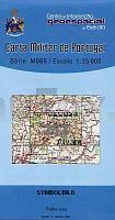
 | 252 - Topographische Landkarte Portugal 1:25.000 Carta Militar de Portugal - Série M888 Instituto Geográfico do Exército (IGeoE) - Portugal |
 | 238T MONTAFON - Malbun - Rätikon - Schruns 1:50.000 *** SCHNÃPPCHEN *** Topographische Wanderkarte SAW der Schweiz - swisstopo |
 | 229 - Ançã - Topographische Landkarte Portugal 1:25.000 Carta Militar de Portugal - Série M888 Instituto Geográfico do Exército (IGeoE) - Portugal |
 | 2318-III Hjørring - mit Wanderwegen und Fahrradrouten Topographische Fahrradkarte und Wanderkarte Dänemark 1:50.000 - Kort & Matrikelstyrelsen ProjektNord 2318-III Hjørring - Topografisk Cykel- og Vandrekort Danmark |
 | 274 - Topographische Landkarte Portugal 1:25.000 Carta Militar de Portugal - Série M888 Instituto Geográfico do Exército (IGeoE) - Portugal |
 | 2115-II-Nà Topographische Karte Dänemark 1:25.000 Topografisk kort Danmark (DTK/Kort25) 2115-II-Nà ProjektNord - Kort & Matrikelstyrelsen / Geodætisk Institut |
 | 2113-IV-Sà Topographische Karte Dänemark 1:25.000 Topografisk kort Danmark (DTK/Kort25) 2113-IV-Sà ProjektNord - Kort & Matrikelstyrelsen / Geodætisk Institut |