| << Portugal: Amtliche topografische Landkarten des Instituto Geográfico do Exército (IGeoE) 1:25.000 (Serie M888) |
  | |
|
||
Zuletzt angesehene Artikel:
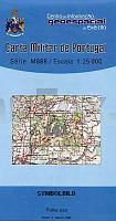
![]() | 161 - Topographische Landkarte Portugal 1:25.000 Carta Militar de Portugal - Série M888 Instituto Geográfico do Exército (IGeoE) - Portugal |
![]() | 3050 Lunow Sonderausgabe mit Wanderwegen - Topographische Wanderkarte Brandenburg 1:25.000 ProjektNord |
![]() | 6127 Volkach Topographische Landkarte Bayern 1:25.000 - Normalausgabe - ProjektNord (geplottete Ausgabe) - Grundlage amtliche Topographische Karte Bayern DTK25 |
![]() | 809-2 TIRTEAFUERA Amtliche topographische Landkarte 1:25.000 Spanien (M.T.N.) 809-2 Mapa Topográfico Nacional de Espana (MTN25) Instituto Geográfico Nacional - CNIG Spanien |
![]() | Cancun & Riviera Maya Pocket Reiseführer Lonely Planet (engl.) |
![]() | Vancouver Stadtplan (British Columbia - Kanada) Vancouver street map GM Johnson |
![]() | 023 Rosaliengebirge - Hohe Wand - Forchtenstein - Thermenregion - Wiener Neustadt 1:50.000 *** SCHNÄPPCHEN *** - Wanderkarte / Radwanderkarte Österreich - GPS - Freytag & Berndt |
![]() | 5303 Roetgen (geplottete Ausgabe) Amtliche topographische Karte 1:25.000 Landesvermessungsamt Nordrhein-Westfalen |
![]() | Krakau - Niepolomice - Konradshof - Groß Salze Stadtplan 1:22.000 Kraków Niepołomice Skawina Wieliczka plan miasta ExpressMap - Polen |
![]() | 4349 Bronkow Sonderausgabe mit Wanderwegen - Topographische Wanderkarte Brandenburg 1:25.000 ProjektNord |
![]() | St. Eustatius (Statia) - Dutch Caribbean 1:10.000 - Landkarte - Street map - GMP - Geographic Map Publishing - midok - Michal Kasprowsky |
![]() | 6225 Würzburg Süd Topographische Landkarte Bayern 1:25.000 - Normalausgabe - ProjektNord (geplottete Ausgabe) - Grundlage amtliche Topographische Karte Bayern DTK25 |
![]() | 573 Santa Cruz (Almodovar) Topographische Landkarte Portugal 1:25.000 Carta Militar de Portugal - Série M888 Instituto Geográfico do Exército (IGeoE) - Portugal |
![]() | Kieler Wanderatlas Allerfeinste Touren rund um Kiel - 40 erprobte Touren - Gratis GPS-Tracks - Exakte Karten - Detailliertes Wegenetz - Anbindung an den ÖPNV - von Jens Uwe Mollenhauer - ProjektNord |
![]() | M1329OT Île de Ré 1:25.000 Mini-Regionalkarte IGN Frankreich |
![]() | Trautenau - Nachod 1:15.000 Stadtplan Trutnov - Nachod SHOCart Tschechien |
![]() | 071 Lanark & Upper Nithsdale - Wanderkarte Großbritannien 1:50.000 Active Laminiert LANDRANGER MAP - Ordnance Survey |
![]() | 5439 Treuen-Herlasgrün (134) - Geologische Karte 1:25.000 (GK25) Grundlage Messtischblatttopographie Sächsisches Landesamt für Umwelt, Landwirtschaft und Geologie |


