| << Portugal: Amtliche topografische Landkarten des Instituto Geográfico do Exército (IGeoE) 1:25.000 (Serie M888) |
||
|
||

Zuletzt angesehene Artikel:
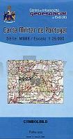
 | 93 - Topographische Landkarte Portugal 1:25.000 Carta Militar de Portugal - Série M888 Instituto Geográfico do Exército (IGeoE) - Portugal |
 | Usedom - Wollin Kreiskarte des Deutschen Reiches 1:100.000 (KDR 100 KK) - Faksimile Reichsamt für Landesaufnahme |
 | 707 Kleine Karpaten Mitte - Červený Kameň, Zochova Chata 1:25.000 Wanderkarte/Radwanderkarete - SHOCart - Tschechien 707 Malé Karpaty-stred, Červený Kameň, Zochova Chata |
 | 90 - Topographische Landkarte Portugal 1:25.000 Carta Militar de Portugal - Série M888 Instituto Geográfico do Exército (IGeoE) - Portugal |
 | Top MTB Trails South Africa - Fahrradatlas Südafrika - MapStudio Südafrika |
 | New Plymouth & Taranaki Towns Minimap 17 Kiwimaps Ltd - Neuseeland |
 | Mecklenburgische Ostseeküste Radkarte mit Ausflugszielen, Einkehr- & Freizeittipps, wetterfest, reissfest, abwischbar, GPS-genau. 1:100000 - von - Freytag-Berndt und ARTARIA Publicpress |
 | 4250 Vetschau / Spreewald Sonderausgabe mit Wanderwegen - Topographische Wanderkarte Brandenburg 1:25.000 ProjektNord |
 | Upernavik (Blatt 6) 1:500.000 VIKING Polar Cruise Series Topographische Landkarte Saga Maps Grönland |
 | U4143 Venejärvi Topographische Karte 1:25.000 EUREF (Peruskartta) Maanmittauslaitos / Lantmäteriverket Finnland - ProjektNord |
 | U5413 Ulmakuusikko Topographische Karte 1:25.000 EUREF (Peruskartta) Maanmittauslaitos / Lantmäteriverket Finnland - ProjektNord |
 | Ukraine StraÃenkarte 1:1.350 Mio. Laminierte touristische Landkarte ExpressMap |