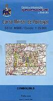
| << Portugal: Amtliche topografische Landkarten des Instituto Geográfico do Exército (IGeoE) 1:25.000 (Serie M888) |
||
|
||

Zuletzt angesehene Artikel:
 | 91 - Topographische Landkarte Portugal 1:25.000 Carta Militar de Portugal - Série M888 Instituto Geográfico do Exército (IGeoE) - Portugal |
 | 93 Topographische Landkarte Wanderkarte und Fahrradkarte Portugal 1:25.000 093 Mapa topográfico - Mapa de caminhadas - Portugal 1:25.000 ProjektNord |
 | 88 Topographische Landkarte Wanderkarte und Fahrradkarte Portugal 1:25.000 088 Mapa topográfico - Mapa de caminhadas - Portugal 1:25.000 ProjektNord |
 | 971-2 CUEVAS DEL CAMPO Amtliche topographische Landkarte 1:25.000 Spanien (M.T.N.) 971-2 Mapa Topográfico Nacional de Espana (MTN25) Instituto Geográfico Nacional - CNIG Spanien |
 | 494 Melides Topographische Landkarte Wanderkarte und Fahrradkarte Portugal 1:25.000 494 Mapa topográfico - Mapa de caminhadas - Portugal 1:25.000 ProjektNord |
 | 5411 Dierdorf - Wanderkarte mit Wanderwegen (geplottete Ausgabe) ProjektNord - Grundlage Amtliche topographische Karte Landesamt für Vermessung und Geobasisinformation Rheinland-Pfalz |
 | 59 Villacarriedo Amtliche topographische Landkarte 1:50.000 Spanien (M.T.N.) 59 Mapa Topográfico Nacional de Espana (MTN50) Instituto Geográfico Nacional - CNIG Spanien |
 | 1048 Jerez de la Frontera Amtliche topographische Landkarte 1:50.000 Spanien (M.T.N.) 1048 Mapa Topográfico Nacional de Espana (MTN50) Instituto Geográfico Nacional - CNIG Spanien |
 | 2317-III-Sà Hou Topographische Karte Dänemark 1:25.000 Topografisk kort Danmark (DTK/Kort25) 2317-III-Sà ProjektNord - Kort & Matrikelstyrelsen / Geodætisk Institut |
 | 909-2 NERPIO Amtliche topographische Landkarte 1:25.000 Spanien (M.T.N.) 909-2 Mapa Topográfico Nacional de Espana (MTN25) Instituto Geográfico Nacional - CNIG Spanien |
 | 587 Villalba de la Sierra Amtliche topographische Landkarte 1:50.000 Spanien (M.T.N.) 587 Mapa Topográfico Nacional de Espana (MTN50) Instituto Geográfico Nacional - CNIG Spanien |
 | 295 (38-12) Banyoles Amtliche topographische Landkarte 1:50.000 Spanien (M.T.N.) 295 Mapa Topográfico Nacional de Espana (MTN50) Instituto Geográfico Nacional - CNIG Spanien |
 | 815 Robledo Amtliche topographische Landkarte 1:50.000 Spanien (M.T.N.) 815 Mapa Topográfico Nacional de Espana (MTN50) Instituto Geográfico Nacional - CNIG Spanien |
 | 817 Pozo-Cañada Amtliche topographische Landkarte 1:50.000 Spanien (M.T.N.) 817 Mapa Topográfico Nacional de Espana (MTN50) Instituto Geográfico Nacional - CNIG Spanien |
 | 153 Podunajska rovina - Diakovce *** SCHNÃPPCHEN *** Wanderkarte Slowakei 1:50.000 - VKU |
 | 5718 Ilbenstadt - Wanderkarte mit Wanderwegen (geplottete Ausgabe) Topographische Landkarte Hessen 1:25.000 - ProjektNord (geplottete Ausgabe) |
 | 981 Gibraleón Amtliche topographische Landkarte 1:50.000 Spanien (M.T.N.) 981 Mapa Topográfico Nacional de Espana (MTN50) Instituto Geográfico Nacional - CNIG Spanien |
 | 166 Villadiego Amtliche topographische Landkarte 1:50.000 Spanien (M.T.N.) 166 Mapa Topográfico Nacional de Espana (MTN50) Instituto Geográfico Nacional - CNIG Spanien |
 | 902-3 ESTACIÃN OBEJO Amtliche topographische Landkarte 1:25.000 Spanien (M.T.N.) 902-3 Mapa Topográfico Nacional de Espana (MTN25) Instituto Geográfico Nacional - CNIG Spanien |
 | 0599 JARAIZ DE LA VERA Topographische Landkarte 1:50.000 Spanien (Grundlage MTN50) Instituto Geográfico Nacional - CNIG Spanien - ProjektNord |