| << Portugal: Amtliche topografische Landkarten des Instituto Geográfico do Exército (IGeoE) 1:25.000 (Serie M888) |
||
|
||

Zuletzt angesehene Artikel:
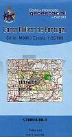
 | 85 - Topographische Landkarte Portugal 1:25.000 Carta Militar de Portugal - Série M888 Instituto Geográfico do Exército (IGeoE) - Portugal |
 | 0213 EL PONT DE SUERT Topographische Landkarte 1:50.000 Spanien (Grundlage MTN50) Instituto Geográfico Nacional - CNIG Spanien - ProjektNord |
 | 0140 ESTELLA-LIZARRA Topographische Landkarte 1:50.000 Spanien (Grundlage MTN50) Instituto Geográfico Nacional - CNIG Spanien - ProjektNord |
 | 0187 OURENSE Topographische Landkarte 1:50.000 Spanien (Grundlage MTN50) Instituto Geográfico Nacional - CNIG Spanien - ProjektNord |
 | 0487 LEDANCA Topographische Landkarte 1:50.000 Spanien (Grundlage MTN50) Instituto Geográfico Nacional - CNIG Spanien - ProjektNord |
 | 96 - Topographische Landkarte Portugal 1:25.000 Carta Militar de Portugal - Série M888 Instituto Geográfico do Exército (IGeoE) - Portugal |
 | 0282 TUDELA Topographische Landkarte 1:50.000 Spanien (Grundlage MTN50) Instituto Geográfico Nacional - CNIG Spanien - ProjektNord |
 | 0090-2 SUNBILLA Topographische Landkarte 1:25.000 Spanien (Grundlage MTN25) Instituto Geográfico Nacional - CNIG Spanien - ProjektNord |
 | 0261 TUI Topographische Landkarte 1:50.000 Spanien (Grundlage MTN50) Instituto Geográfico Nacional - CNIG Spanien - ProjektNord |
 | 931 Zarcilla de Ramos Amtliche topographische Landkarte 1:50.000 Spanien (M.T.N.) 931 Mapa Topográfico Nacional de Espana (MTN50) Instituto Geográfico Nacional - CNIG Spanien |
 | 855 Usagre Amtliche topographische Landkarte 1:50.000 Spanien (M.T.N.) 855 Mapa Topográfico Nacional de Espana (MTN50) Instituto Geográfico Nacional - CNIG Spanien |
 | 92 Topographische Landkarte Wanderkarte und Fahrradkarte Portugal 1:25.000 092 Mapa topográfico - Mapa de caminhadas - Portugal 1:25.000 ProjektNord |
 | 966 Montilla Amtliche topographische Landkarte 1:50.000 Spanien (M.T.N.) 966 Mapa Topográfico Nacional de Espana (MTN50) Instituto Geográfico Nacional - CNIG Spanien |
 | 917 Aracena Amtliche topographische Landkarte 1:50.000 Spanien (M.T.N.) 917 Mapa Topográfico Nacional de Espana (MTN50) Instituto Geográfico Nacional - CNIG Spanien |
 | 858 El Viso Amtliche topographische Landkarte 1:50.000 Spanien (M.T.N.) 858 Mapa Topográfico Nacional de Espana (MTN50) Instituto Geográfico Nacional - CNIG Spanien |
 | 583 Odeleite Topographische Landkarte Wanderkarte und Fahrradkarte Portugal 1:25.000 583 Mapa topográfico - Mapa de caminhadas - Portugal 1:25.000 ProjektNord |
 | 915 Rosal de la Frontera Amtliche topographische Landkarte 1:50.000 Spanien (M.T.N.) 915 Mapa Topográfico Nacional de Espana (MTN50) Instituto Geográfico Nacional - CNIG Spanien |
 | 98 - Topographische Landkarte Portugal 1:25.000 Carta Militar de Portugal - Série M888 Instituto Geográfico do Exército (IGeoE) - Portugal |
 | 836 Mestanza Amtliche topographische Landkarte 1:50.000 Spanien (M.T.N.) 836 Mapa Topográfico Nacional de Espana (MTN50) Instituto Geográfico Nacional - CNIG Spanien |
 | 989-2 PRIEGO DE CÃRDOBA Amtliche topographische Landkarte 1:25.000 Spanien (M.T.N.) 989-2 Mapa Topográfico Nacional de Espana (MTN25) Instituto Geográfico Nacional - CNIG Spanien |