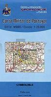
| << Portugal: Amtliche topografische Landkarten des Instituto Geográfico do Exército (IGeoE) 1:25.000 (Serie M888) |
||
|
||

Zuletzt angesehene Artikel:
 | 62 - Topographische Landkarte Portugal 1:25.000 Carta Militar de Portugal - Série M888 Instituto Geográfico do Exército (IGeoE) - Portugal |
 | 6 II c - Topographische Landkarte Portugal 1:50.000 Carta Militar de Portugal Instituto Geográfico do Exército (IGeoE) - Portugal |
 | 1 Nordfriesland / Schleswig *** SCHNÃPPCHEN *** ADFC-Radtourenkarte 1:150.000 Bielefelder Verlag |
 | 6015 Mainz - Wanderkarte mit Wanderwegen (geplottete Ausgabe) ProjektNord - Grundlage Amtliche topographische Karte Landesamt für Vermessung und Geobasisinformation Rheinland-Pfalz |
 | Arzachena *** SCHNÃPPCHEN *** Topographische Wanderkarte Sardinien 1:30.000 (deu./engl./frz./ital.) Carta turistico-escursionistica di Arzachena Edizioni Abies |
| Salem / Keizer City-Stadtplan 1:32.000 laminiert (Ohio - USA) Salem / Keizer city map laminated GM Johnson |
 | 588 Salir (Loulé) Topographische Landkarte Portugal 1:25.000 Carta Militar de Portugal - Série M888 Instituto Geográfico do Exército (IGeoE) - Portugal |
| L38-3-C Sacharow 1:50.000 - Amtliche Topographische Karte der Russischen Föderation |
 | Heilige Sprachen 3 in 1 - Kauderwelsch Jubiläumsband 8 Kauderwelsch-Sprachführer, Kauderwelsch Jubiläumsband 8 Reise-Know-How Verlag |
 | Motorrad Reiseführer Sardinien auf dem Motorrad entdecken BikerBetten Motorradreisebuch - Touristik-Verlag Vellmar |
 | Japan (Süd) 1:670.000 *** SCHNÃPPCHEN *** Landkarte - ITMB International Travel Reference Maps (engl.) Japan South |
 | 4413 Werl (geplottete Ausgabe) Amtliche topographische Karte 1:25.000 Landesvermessungsamt Nordrhein-Westfalen |
 | 571 Santa Clara-a-Nova (Almodovar) Topographische Landkarte Portugal 1:25.000 Carta Militar de Portugal - Série M888 Instituto Geográfico do Exército (IGeoE) - Portugal |
 | 562 Santa Clara-A-Velha (Odemira) Topographische Landkarte Portugal 1:25.000 Carta Militar de Portugal - Série M888 Instituto Geográfico do Exército (IGeoE) - Portugal |
 | 5909 Zell (Mosel) - Wanderkarte mit Wanderwegen (geplottete Ausgabe) ProjektNord - Grundlage Amtliche topographische Karte Landesamt für Vermessung und Geobasisinformation Rheinland-Pfalz |
 | 6007 Wittlich - Wanderkarte mit Wanderwegen (geplottete Ausgabe) ProjektNord - Grundlage Amtliche topographische Karte Landesamt für Vermessung und Geobasisinformation Rheinland-Pfalz |
 | 6643 Furth im Wald Topographische Landkarte Bayern 1:25.000 - Normalausgabe - ProjektNord (geplottete Ausgabe) - Grundlage amtliche Topographische Karte Bayern DTK25 |