| << Deutschland: Topographische Karten 1:50.000 im Regelblattschnitt nach Blattnummern (4500-8999) << Hessen: Topographische Landkarten 1:50.000 im Regelblattschnitt - von ProjektNord |
  | |
Zuletzt angesehene Artikel:
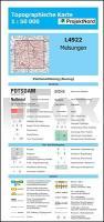
![]() | L4922 Melsungen (geplottete Ausgabe) Topographische Landkarte Hessen 1:50.000 - ProjektNord |
![]() | 2919 Bremen Ost Amtliche topographische Karte 1:25.000 Landesvermessungsamt Niedersachsen |
![]() | Klettern in Östergötland Kletterführer schwedisch Klättring i Östergötland Calazo Förlag Schweden |
![]() | Pommern PLANO Historische Übersichtskarte 1:300.000 - BKG Bundesamt für Kartographie und Geodäsie |
![]() | Historische WELTKARTE 1641 - Henricus Hondius - Historische Landkarte Originalinschrift der World Map: Nova Totivs Terrarvm Orbis Geographica Ac Hydrographica Tabvla | Weltkarten Vol. 2 - von Hondius Henricus - PLANO gerollt - Verlag Rockstuhl |
![]() | 283 AROLLA 1:50.000 - Grand Combin - Lac des Dix - Matterhorn - Topographische Landeskarte der Schweiz - swisstopo |
![]() | 3948 Oderin Sonderausgabe mit Wanderwegen - Topographische Wanderkarte Brandenburg 1:25.000 ProjektNord |
![]() | 03 Appennino Fiorentino 1:25.000 (AF03) - Firenze e Val di Sieve - Wanderkarte Italien - D.R.E.A.M. Italia Carta dei sentieri della provincia di Firenze |
![]() | DuMont Reise-Taschenbuch Franken Reiseführer plus Reisekarte. Mit individuellen Autorentipps und vielen Touren - von Roland Dusik - DuMont Reiseverlag |
![]() | 3722 Lauenau Topographische Wanderkarte 1:25.000 Niedersachsen mit Wanderwegen - ProjektNord |
![]() | 2842 Flecken Zechlin Sonderausgabe mit Wanderwegen - Topographische Wanderkarte Brandenburg 1:25.000 ProjektNord |
![]() | MARCO POLO Reiseatlas Großbritannien, Irland 1:300.000 (Spiralbindung) mit Europa 1:4.5 Mio. MAIRDUMONT |
![]() | 2318 Drangstedt Amtliche topographische Karte 1:25.000 Landesvermessungsamt Niedersachsen |
![]() | 3620 Niedernwöhren Topographische Wanderkarte 1:25.000 Niedersachsen mit Wanderwegen - ProjektNord |
![]() | 3925 Sibbesse Topographische Wanderkarte 1:25.000 Niedersachsen mit Wanderwegen - ProjektNord |
![]() | Flandern 1592 Historische Landkarte auf Pergament (Faksimile) - 50 x 37,5 cm - PLANO gerollt Antica |
![]() | P4222 Ina Topographische Karte 1:25.000 EUREF (Peruskartta) Maanmittauslaitos / Lantmäteriverket Finnland - ProjektNord |
![]() | NA520 Mustang - Annapurna Trekkingkarte (Annapurna) 1:165.000 Lo Manthang - Damodar Kunda - Saribung - Phu - Himalayan MapHouse - Nepal |
![]() | L2138 Schwaan Amtliche Topographische Karte 1:50.000 Landesvermessungsamt Mecklenburg-Vorpommern |
![]() | 2934 Lenzen (Elbe) Topographische Karte 1:25.000 Landesvermessungsamt Brandenburg (gefaltet) |


