| << Deutschland: Historische Topographische Karten 1:25.000 der ehem. deutschen Ostgebiete und besetzten Gebiete |
  | |
|
||
Zuletzt angesehene Artikel:
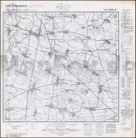
![]() | 5068 Rothbach Topographische Karte 1:25.000 Messtischblatt des Deutschen Reiches - Preußische Landesaufnahme / Reichsamt für Landesaufnahme - Faksimile ProjektNord |
![]() | 3019SB Châteauvillain - Montigny-sur-Aube GPS Amtliche Topographische Wanderkarte Frankreich 1:25.000 - série bleue (IGN) |
![]() | 0777 MÉRIDA Topographische Landkarte 1:50.000 Spanien (Grundlage MTN50) Instituto Geográfico Nacional - CNIG Spanien - ProjektNord |
![]() | 0777-2 MÉRIDA Topographische Landkarte 1:25.000 Spanien (Grundlage MTN25) Instituto Geográfico Nacional - CNIG Spanien - ProjektNord |
![]() | Ventura / Oxnard / Camarillo / Ojai Stadtplan 1:32.000 (Kalifornien - USA) Ventura / Oxnard / Camarillo / Ojai street map Global Graphics / GM Johnson |
![]() | 1040 ZAFARRAYA Topographische Landkarte 1:50.000 Spanien (Grundlage MTN50) Instituto Geográfico Nacional - CNIG Spanien - ProjektNord |
![]() | P5212 Lapinlahti Topographische Karte 1:25.000 EUREF (Peruskartta) Maanmittauslaitos / Lantmäteriverket Finnland - ProjektNord |
![]() | Sima - Sajansk Stadtplan Russland Зима - Саянск FGUP Vostočno sibirskoe aerogeodezičekoe predprijatie - VostSib AGP |
![]() | 0282-1 CORELLA Topographische Landkarte 1:25.000 Spanien (Grundlage MTN25) Instituto Geográfico Nacional - CNIG Spanien - ProjektNord |
![]() | 1040-1 ZAFARRAYA Topographische Landkarte 1:25.000 Spanien (Grundlage MTN25) Instituto Geográfico Nacional - CNIG Spanien - ProjektNord |
![]() | NM 33-11-16 West (4316-West) Rappottenstein Österreichische Karte 1:25.000 mit Wegmarkierungen (topographische Wanderkarte - UTM) - BEV - Österreich - Vergrößerung (ÖK25V) |
![]() | L5244 Nuijamaa Topographische Karte 1:25.000 EUREF (Peruskartta) Maanmittauslaitos / Lantmäteriverket Finnland - ProjektNord |
![]() | NL 33-02-20 (4220) Pöls Österreichische Karte 1:50.000 mit Wegmarkierungen (topographische Wanderkarte - UTM) - BEV - Österreich |
![]() | 12-414 Černošice (Cernosice) Topographische Karte 1:25.000 der Tschechischen Republik Zakladní mapa Ceská republika - Cesky urad zememericky a katastralni - ProjektNord |
![]() | Lövskär - Askgrund - Parainen Hafenkarte 105 - 1:20.000 Lövskär - Askgrund - Parainen Satamakartta 105 - 1:20.000 Finnland |
![]() | 0886-3 SORIHUELA DEL GUADALIMAR Topographische Landkarte 1:25.000 Spanien (Grundlage MTN25) Instituto Geográfico Nacional - CNIG Spanien - ProjektNord |
![]() | N-33-69-A/B Koszalin Amtliche topographische Landkarte Polen 1:50.000 N-33-69-A/B Koszalin - Mapa Topograficzna Polski Glowny Geodeta Kraju |
![]() | 29 Allenstein - Karte des Deutschen Reiches 1:100.000 (KDR 100 GB) - Großblatt Reichsamt für Landesaufnahme / Preußische Landesaufnahme ProjektNord |
![]() | M-34-40-C/D Koniecpol Amtliche topographische Landkarte Polen 1:50.000 M-34-40-C/D Koniecpol - Mapa Topograficzna Polski Glowny Geodeta Kraju |


