| << Dänemark: Topographische Landkarten 1:100.000 |
  | |
|
||
Zuletzt angesehene Artikel:
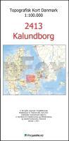
![]() | 2413 Kalundborg - Topografische Landkarte Dänemark 1:100.000 Kalundborg - Danmark Topografisk kort 1:100.000 Kort & Matrikelstyrelsen |
![]() | Teheran Township - Straßenkarte 1:55.000 (Blatt 125) Landkarte / Straßenkarte Tehran Township Iranshenasi - Iran |
![]() | W5232 Topographische Karte 1:25.000 EUREF (Peruskartta) Maanmittauslaitos / Lantmäteriverket Finnland - ProjektNord |
![]() | Beauvaisis en 1605 Historische Landkarte auf Pergament (Faksimile) - 50 x 37,5 cm - PLANO gerollt Antica |
![]() | Trollheimen Nord Wanderkarte Norwegen 1:50.000 (Blatt 2827) - Nordeca / UGLAND / Statens Kartverk Norwegen Trollheimen Nord |
![]() | R5222 Ruottisenharju Topographische Karte 1:25.000 EUREF (Peruskartta) Maanmittauslaitos / Lantmäteriverket Finnland - ProjektNord |
![]() | Metropolregion Stuttgart MPR250 Übersichts- und Stadtkarten mit Freizeittipps 1:250.000 - Bundesamt für Kartografie und Geodäsie und Landesvermessungsämter |
![]() | Slawutytsch Stadtplan 1:4.000 (kyrillisch) Славутич Kartografija - ukrmap Ukraine |
![]() | Nigeria und Niger 1:1.6 Mio. / 1:2 Mio. Landkarte - ITMB International Travel Reference Map (engl.) Nigeria & Niger ITMB International Travel Maps (engl.) |
![]() | 1162 LES VERRIERES 1:25.000 - Pontalier - Les Bayards - Les Gras - Topographische Landeskarte der Schweiz - swisstopo |
![]() | T4232 Pello Topographische Karte 1:25.000 EUREF (Peruskartta) Maanmittauslaitos / Lantmäteriverket Finnland - ProjektNord |
![]() | W5231 Topographische Karte 1:25.000 EUREF (Peruskartta) Maanmittauslaitos / Lantmäteriverket Finnland - ProjektNord |
![]() | W4332 Topographische Karte 1:25.000 EUREF (Peruskartta) Maanmittauslaitos / Lantmäteriverket Finnland - ProjektNord |
![]() | W4341 Topographische Karte 1:25.000 EUREF (Peruskartta) Maanmittauslaitos / Lantmäteriverket Finnland - ProjektNord |
![]() | P4224 Veteli Topographische Karte 1:25.000 EUREF (Peruskartta) Maanmittauslaitos / Lantmäteriverket Finnland - ProjektNord |
![]() | W3341 Topographische Karte 1:25.000 EUREF (Peruskartta) Maanmittauslaitos / Lantmäteriverket Finnland - ProjektNord |
![]() | W4342 Topographische Karte 1:25.000 EUREF (Peruskartta) Maanmittauslaitos / Lantmäteriverket Finnland - ProjektNord |
![]() | 25107 Monte Tamaro - Serie Gipfel 1:25.000 Gambarogno - Monte Lema - Lugano - Topographische Wanderkarte der Schweiz - swisstopo |
![]() | S4322 Simo Topographische Karte 1:25.000 EUREF (Peruskartta) Maanmittauslaitos / Lantmäteriverket Finnland - ProjektNord |
![]() | W5112 Inari Topographische Karte 1:25.000 EUREF (Peruskartta) Maanmittauslaitos / Lantmäteriverket Finnland - ProjektNord |


