| << Norwegen: Fjellkarten - Cappelens Kart << Cappelen Damm - Norwegen |
  | |
Zuletzt angesehene Artikel:
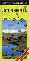
![]() | CK45: Jotunheimen Fjellkart 1:100.000 / 1:50.000 Cappelens Kart - Wanderkarte Norwegen |
![]() | 4535 Erdeborn Topographische Karte 1:25.000 Landesamt für Vermessung und Geoinformation Sachsen-Anhalt (Landesvermessungsamt) |
![]() | 3128 E SAINT AMOUR GPS Amtliche Topographische Wanderkarte Frankreich 1:25.000 - série bleue (IGN) |
![]() | Cloppenburg Topographische Wanderkarte mit Wanderwegen und Radwegen 1:25.000 Niedersachsen - ProjektNord |
![]() | 02 La Via dei Campioni 1:25.000 - San Sebastiano Curone - Selvapiana - Rad- und Wanderkarte - Ingenia Editori - Italien Carta cicloescursionistica del tratto compreso tra San Sebastiano Curone e Selvapiana sulla Via dei Campioni |
![]() | 3313SB Ars-sur-Moselle - Chambley-Bussières GPS Amtliche Topographische Wanderkarte Frankreich 1:25.000 - série bleue (IGN) |
![]() | 2548OT PERPIGNAN - PLAGES DU ROUSSILLON Topographische Wanderkarte Frankreich 1:25.000 TOP 25 IGN - (GPS) |
![]() | 2830SB ROANNE - THIZY GPS Amtliche Topographische Wanderkarte Frankreich 1:25.000 - série bleue (IGN) |
![]() | 2324SB Bourges / Mehun-sur-Yèvre GPS Amtliche Topographische Wanderkarte Frankreich 1:25.000 - série bleue (IGN) |
![]() | 0317OT ÃŽLE D`OUESSANT Topographische Wanderkarte Frankreich 1:25.000 TOP 25 IGN - (GPS) |
![]() | OL22 New Forest - Wanderkarte Großbritannien 1:25.000 NEW EXPLORER MAP - Ordnance Survey |
![]() | N-33-58-A/B Ustka Amtliche topographische Landkarte Polen 1:50.000 N-33-58-A/B Ustka - Mapa Topograficzna Polski Glowny Geodeta Kraju |
![]() | 45 Ahrensbök - Scharbeutz - Süsel - Varendorfsche Karte 1789-1792 Topographisch Militärische Charte des Herzogtums Holstein - Reproduktion 1:25.000 |
![]() | M-33-21-A/B Glogow Amtliche topographische Landkarte Polen 1:50.000 M-33-21-A/B Glogow - Mapa Topograficzna Polski Glowny Geodeta Kraju |
![]() | Danube Bike Trail - Part 3: Slovakian and Hungarian Danube (Radwanderführer englisch) From Vienna to Budapest. 1:75. 000, 340 km. 1:75.000 - Esterbauer |
![]() | 21J SV VINDELN 1:50.000 *** SCHNÄPPCHEN *** Topographische Wanderkarte Schweden (Terrängkarta/Gröna Kartan) - Kartförlaget - Lantmäteriet Landkarte Schweden |
![]() | 6809 Gersheim Topographische Karte 1:25.000 - Landesvermessungsamt Saarland |
![]() | Sylan Sør Wanderkarte Norwegen 1:100.000 (Blatt 2776) - Nordeca / UGLAND / Statens Kartverk Norwegen |
![]() | Turin Stadtplan 1:16.000 Torino - Pianta della Citta L.A.C. GlobalMap Italien |
![]() | 3839 Reppinichen Topographische Karte 1:25.000 Landesamt für Vermessung und Geoinformation Sachsen-Anhalt (Landesvermessungsamt) |


