| << Frankreich: Radwanderkarten und Radwanderführer << SPORTOENA - grenzüberschreitende Fahrradkartenserie Deutschland / Belgien / Frankreich |
  | |
|
||
Zuletzt angesehene Artikel:
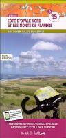
![]() | Côte d´Opale Nord et les Monts de Flandre (Blatt 35) Fahrradkarte und Wanderkarte Frankreich 1:50.000 SPORTOENA |
![]() | Estlands Fahrradrouten 1:500.000 Fahrradkarte Eesti Jalgrattateed - EOMAP Estland |
![]() | 159 S Vesterålen SØR 1:50.000 - Amtliche Topographische Landkarte Norwegen - Startens Kartverk |
![]() | BB31 Manukau Harbour Topographische Landkarte Neuseeland 1:50.000 Land Information New Zealand |
![]() | Umbrien Reiseführer Michael-Müller-Verlag - Reiseführer |
![]() | L2546 Woldegk Amtliche Topographische Karte 1:50.000 Landesvermessungsamt Mecklenburg-Vorpommern |
![]() | 5808 Cochem Topographische Karte 1:25.000 - Landesamt für Vermessung und Geobasisinformation Rheinland-Pfalz |
![]() | Paphos (Blatt 24) Stadtplan Zypern 1:9.000 Orama - Griechenland ΠΑΦΟΣ ΠΟΛΗ |
![]() | 32D WOUDENBERG Topographische Karte der Niederlande 1:25.000 (Plotausgabe) 32D WOUDENBERG Topografische Kaart van Nederland Kadaster - ProjektNord |
![]() | 52D HELENAVEEN Topographische Karte der Niederlande 1:25.000 (Plotausgabe) 52D HELENAVEEN Topografische Kaart van Nederland Kadaster - ProjektNord |
![]() | Pfälzerwald 10 - Annweiler am Trifels Topographische Wanderkarte Rheinland-Pfalz mit Wanderwegen und Radwegen 1:25.000 - ProjektNord |
![]() | 5115 Ewersbach Topographische Landkarte Hessen 1:25.000 - ProjektNord (geplottete Ausgabe) |
![]() | 52B VENRAY Topographische Karte der Niederlande 1:25.000 (Plotausgabe) 52B VENRAY Topografische Kaart van Nederland Kadaster - ProjektNord |
![]() | Columbus Street Map (Ohio) Stadtplan - Rand McNally - USA |
![]() | Staaten Europas POSTER 97 x 67 cm - Stiefel EUROCART 1:1.720.000 |
![]() | 55C KEMEL Topographische Karte der Niederlande 1:25.000 (Plotausgabe) 55C KEMEL Topografische Kaart van Nederland Kadaster - ProjektNord |
![]() | Puyehue 1:75.000 / 1:25.000 Topographische Reise - und Wanderkarte Puyehue Topographic Travel Map Viachile Editores - Chile |
![]() | Ligurien - Cinque Terre (Nr. 5752) Wanderführer mit Extra-Tourenkarte, 50 Touren, GPX-Daten zum Download - KOMPASS-Karten |
![]() | BU21 Topographische Landkarte Neuseeland 1:50.000 Land Information New Zealand |


