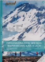
| << Chile: Trekkingkarten |
  | |
Zuletzt angesehene Artikel:
![]() | 4: Parque Nacional Radal Siete Tazas - Riserva Nacional Altos de Lircay 1:80.000 - Regíon del Maule - Trekkingkarte - Andes-handbook - Chile |
![]() | Troodos Region - Hiking Map Cyprus Agios Demetrios - Amiantos - Foini - Karvounas - Kato Platres - Lemithou - Mandria - Moniatis - Palaiomylos - Pano Platres - Pedoulas - Pera Pedi - Prodromos - Troodos - Wanderkarte 1:25.000, GPS-genau - Kartographos |
![]() | 47 MONTE ROSA 1:100.000 Topographische Landeskarte der Schweiz - swisstopo |
![]() | TL07 Breton 1:50.000 Topographische Landkarte Tasmanien - Australien - Tasmap (Tasmanien) |
![]() | Japan PLANO-Karte 1:3 Mio. - gerollt im Plastikrohr Japan flat map National Geographic |
![]() | Nürnberg 1982 (Blatt 197) Historischer Bildstadtplan Bollmann-Bildkarten-Verlag |
![]() | Kapstadt - 101 Ausflugsziele im Umkreis von 200 Km Straßenkarte 1:425.000 slingsby´s Day drives from Cape Town - 101 destinations 200 km or less from the city centre |
![]() | TC01 Cape Wickham 1:50.000 Topographische Landkarte Tasmanien - Australien - Tasmap (Tasmanien) |
![]() | 21 Insel Losinj - Wanderkarte 1:25.000 Otok Losinj - Planinarska Karta Smand Kroatien |
![]() | 2014SB Saint-André-de-l`Eure - Nonancourt GPS Amtliche Topographische Wanderkarte Frankreich 1:25.000 - série bleue (IGN) |
![]() | Weißrussland 1:600.000 Landkarte - ITMB International Travel Maps (engl.) Belarus |
![]() | 2811SB Asfeld GPS Amtliche Topographische Wanderkarte Frankreich 1:25.000 - série bleue (IGN) |
![]() | 344.12 Amtliche topographische Karte 1:25.000 Polen |
![]() | Pinery Provincial Park (Ontario) (waterproof) 1:20.000 The Adventure Map - Chrismar Mapping - Kanada |
![]() | Düsseldorf 1962 (Blatt 34) Historischer Bildstadtplan Bollmann-Bildkarten-Verlag |
![]() | Fürstenberg - Feldberg - Templin (wasserfest) Kartenset 3 Rad-, Wander- und Gewässerkarten 1:35.000 (Feldberger Seen / Fürstenberg - Havel - Lychen - Templin) - Grünes Herz |
![]() | 1920 Meldorf Topographische Landkarte 1:25.000 Landesvermessungsamt Schleswig-Holstein |
![]() | Narsarsuaq 1:10.000 (Blatt 6) Laminierter Ortsplan Kort 6: NARSARSUAQ Arctic Sun Maps - Grönland |
![]() | Pedals du TOURMALET 1:50.000 Fahrradkarte Frankreich - Monteditorial |
![]() | 135 Nevers - Autun Topographische Touristische Landkarte Tourismus und Fahrrad (wasserfest) - tourisme et vélo plastifiée TOP100 - 1:100.000 - IGN Frankreich |


