Willkommen bei MapFox
+++ Buchhändleranfragen willkommen! Tel. 0431-666 75 99 +++
Warenkorb
Artikel: 0 - € 0.00
Zur Kasse
Impressum Kontakt Versandkosten AGB
Paragliding Annapurna 1:25.000 / 1:40.000 / 1:50.000 / 1:75.000 / 1:80.000 (NA512) Himalayan MapHouse - Nepal
<< Nepal
<< Himalayan Map House
 
Cover

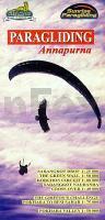
Spezielle Paragliding-Karte für das Annapurna-Gebiet. Die Landkarte enthält Angaben zu Thermik, Windrichtungen, Start- und Landeplätzen, Flugverbotszonen usw.

Mit folgenden Detailkarten:
Sarangkot Drop 1:25.000
The Green Wall 1:50.000
Korchon Circuit 1:80.000
Sarangkot Naudanda 1:40.000
Pokhara Besi Sahar 1:75.000
Pokhara Valley 1:50.000

Kartenbeispiel

Paragliding Annapurna 1:25.000 / 1:40.000 / 1:50.000 / 1:75.000 / 1:80.000 (NA512) Himalayan MapHouse - Nepal
EAN / ISBN: 9789993323983
Preis: EUR 24.50

sofort versandfertig Dieser Artikel ist im Normalfall sofort lieferbar.
Produkt EUR Anzahl Bestellen
Paragliding Annapurna 1:25.000 / 1:40.000 / 1:50.000 / 1:75.000 / 1:80.000 (NA512) Himalayan MapHouse - Nepal 24.50
Versandkostenfrei in Deutschland

incl. MwSt.

Stichworte, die bei der Suche nützlich sein könnten:
Pokhara Valley - Sarangkot Naudanda - Sarangkot Drop - Nepal - Korchon Circuit - Annapurna - Pokhara Besi Sahar - The Green Wall - Nepal - Nepal Landkarten - Nepal Reiseführer - Nepal Atlanten - Nepal Kartographie - Nepal Fahrradkarten - Nepal Radwanderkarten - Nepal Karten - Nepalkarten - Nepal Kartografie - Nepal Wanderkarten - Nepal Landkartenverkauf - Nepal Radwanderführer - Nepal Straßenkarten - Himalayan Map House - Nepal - Himalaya Trekkingkarten - Nepal Landkarten

Zuletzt angesehene Artikel:

CoverParagliding Annapurna 1:25.000 / 1:40.000 / 1:50.000 / 1:75.000 / 1:80.000 (NA512) Himalayan MapHouse - Nepal

CoverReinhardswald Nord Topographische Wanderkarte mit Wanderwegen 1:25.000 - ProjektNord

Cover533-2 COLLADO VILLALBA Amtliche topographische Landkarte 1:25.000 Spanien (M.T.N.)
533-2 Mapa Topográfico Nacional de Espana (MTN25) Instituto Geográfico Nacional - CNIG Spanien

Cover583-1 ARGANDA DEL REY Amtliche topographische Landkarte 1:25.000 Spanien (M.T.N.)
583-1 Mapa Topográfico Nacional de Espana (MTN25) Instituto Geográfico Nacional - CNIG Spanien

CoverSinai - The trekking guide Reiseführer (englisch) - Trailblazer

Cover10 Sachsen-Anhalt Autokarte + Freizeitkarte 1:200.000 freytag & berndt

CoverFreeride Map Les Deux Alpes 1:25.000 Topographische Skitourenkarte / Snowboardtourenkarte Frankreich (franz./engl.) - FREERIDE-MAP outcomm

CoverLofoten Mit 12 Inselrouten u. 20 Wanderungen Michael Möbius - Edition Elch

Cover223-3 / 222-4 Vigo (07-22) Amtliche topographische Landkarte 1:25.000 Spanien (M.T.N.)
223-3 Mapa Topográfico Nacional de Espana (MTN25) Instituto Geográfico Nacional - CNIG Spanien

CoverZentral Tian Schan Karte und Kurzführer 1:150.000 (englisch / deutsch) Inylchek to Baiankol Zentralasien
Central Tien Shan Map & Guide - Central Asia EWP - WEST COL PRODUCTIONS

Cover1284 MONTHEY 1:25.000 Topographische Landeskarte der Schweiz - swisstopo

CoverAbuja The premier guidebook for Business Globetrotters (englisch)
AbujaCity Guide eBiz Guides

CoverKamjanez-Podilskyj / Kamjenez-Podolski / Kamenez-Podolski Stadtplan 1:10.000
Kamianets Podils`ky Kartografija - ukrmap Ukraine

CoverSumy Stadtplan 1:17.000
Sumy Kartografija - ukrmap Ukraine

Noch kein Cover vorhandenVanderhoof - TOPO (Blatt NOBC10) Topographische Landkarte - Backroad Topo Map Kanada

Cover1093 HORNLI 1:25.000 - Bauma - Fischingen - Lichtensteig - Topographische Landeskarte der Schweiz - swisstopo

CoverGhana 1:500.000 / 1:570.000 Landkarte - ITMB International Travel Maps (engl.)

CoverChugach State Park, Anchorage (Blatt 764) GPS 1:75.000 / Alaska Landkarte Trails Illustrated Map wasserfest National Geographic - USA

Cover29 Langanes Atlaskort - Topographische Landkarte Island 1:100.000
Langanes Forlagid - Mál og menning - Island

CoverVia dei Tusci (Blatt 26) Trek - MTB - Official map Wanderkarte 1:25.000
Carta Escursionistica Edizioni Il Lupo - Italien