Willkommen bei MapFox
Wurde Ihre Bestellung bestätigt? Wenn nicht - gab es evtl. ein SERVER-Problem! Bitte kontaktieren Sie uns! +++ Buchhändler-Anfragen erwünscht +++
Warenkorb
Artikel: 0 - € 0.00
Zur Kasse
Widerruf Impressum Kontakt Versandkosten AGB
Island Touristenkarte 1:500.000
Iceland - Islande Touring map - Carte Touristique Icelandroadmap
<< Island
 
Cover

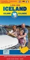
- High quality overall map of the country in the scale 1:500 000 with the latest official update about the road system.
- Important tourist information on the map such as accommodation, camping sites, museums, filling stations, swimming pools, boat tours etc.
- Photos and information for 34 tourist attractions around the country.
- Explanation of Icelandic place names.
- Night & daylight scheme.
- List of volcanic eruptions from the year 1700 - 2012.
- Some interesting facts about Iceland.
- Useful information of how to drive in Iceland.
- Distance table.
- Place name index.

Kartenbeispiel

Island Touristenkarte 1:500.000
Iceland - Islande Touring map - Carte Touristique Icelandroadmap
EAN / ISBN: 9789935925428
Preis: EUR 16.90

Dieser Titel ist momentan nicht lieferbar.
Produkt EUR Anzahl Bestellen
Island Touristenkarte 1:500.000
Iceland - Islande Touring map - Carte Touristique Icelandroadmap
16.90
Versandkostenfrei in Deutschland ab 30,- Bestellwert

incl. MwSt.

Stichworte, die bei der Suche nützlich sein könnten:
Vegahandbokin EHF - Islande Carte Touristique - Island Landkarte - Islande - Island - Island Straßenkarte - Iceland - Iceland Touring map - Island Autokarte - Island - Iceland

Zuletzt angesehene Artikel:

CoverIsland Touristenkarte 1:500.000
Iceland - Islande Touring map - Carte Touristique Icelandroadmap

CoverIsergebirge (Blatt 23) Topographische Wanderkarte 1:25.000 EUROKART (tschechisch)
Jizerské hory - Góry Iserskie - Hejnice - Frýdlant - Nové Město pod Smrkem - Lázně Libverda - Bedřichov - Desná - Ferdinandov - Jizerka - Liberec - Smědava Geodezie On Line - Tschechien

CoverNationalpark Snæfellsjökull und Naturschutzgebiete der Umgebung *** SCHNÄPPCHEN *** Wanderkarte 1:100.000 -
þjóðgarðurinn Snæfellsjökull og friðlönd í nágrenninu Umhverfisstofnun - Island

Cover059 NP Monti Lessini Topographische Wanderkarte 1:25.000 - Casa Editrice Tabacco - Italien

CoverItalien PLANO-Karte 1:1.76 Mio. (Format: 59 x 87 cm) - gerollt im Plastikrohr
Italy flat map National Geographic

Cover32 Jungfrauregion MTB-Karte 1:50.000 Grindelwald - Interlaken - Meiringen - Swiss Singletrail Map

CoverMallorca - Ibiza - Menorca Regionale Straßenkarte 1:140.000 (Blatt 579) Michelin Spanien