| << Rumänien: Wanderkarten von Zenith |
||
|
||
Zuletzt angesehene Artikel:
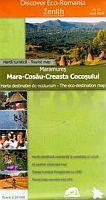
 | Maramureș 1:35.000 (Blatt 12) Touristische Wanderkarte - Bergwanderkarte Mara - Cosău - Creasta Cocoșului - Harta turistica / Tourist map Zenith - Rumänien |
 | 4434 Mansfeld Topographische Karte 1:25.000 Landesamt für Vermessung und Geoinformation Sachsen-Anhalt (Landesvermessungsamt) |
 | Mecklenburgische Schweiz *** SCHNÄPPCHEN *** Fahrradkarte 1:75.000 - Grünes Herz |
| M-34-45/46 Krasnik Plot aus der Kartengrundlage der amtliche topographische Karte Polen 1:100.000 ProjektNord |
 | 604 Eskilstuna - Terrängkartan 1:50.000 Topographische Wanderkarte Schweden - Lantmäteriet Landkarte Schweden |
 | 8329 Nesselwang Ost Topographische Landkarte Bayern 1:25.000 - Normalausgabe - ProjektNord (geplottete Ausgabe) - Grundlage amtliche Topographische Karte Bayern DTK25 |
 | Mauretanien - Westsahara - geografische Landkarte 1:1.75 Mio. MAURETANIA (geographical map) GiziMap |
 | 23 MECHELEN NGI 1:50.000 Topographische Karte Belgien |
 | Mälartal- Touristen- und Fahrradführer - Mälardalsleden (Teile 1+2) 1:100.000 Turist & Cykelguide Mälardalen - Svea rikes centrum - Mälardalsleden Del 1+2 Svenska Cykelsällskapet - Schweden |
 | 451 Thurso & John oGroats - laminierte Wanderkarte Großbritannien 1:25.000 EXPLORER MAP - Ordnance Survey |
| M-34-105/106 Cisna Plot aus der Kartengrundlage der amtliche topographische Karte Polen 1:100.000 ProjektNord |
 | Caserta Provinzialautokarte - Straßenkarte 1:150.000 - Italien Caserta - Carta stradale della Provincia - Italia L.A.C. GlobalMap Italien |
 | Móra d`Ebre (Blatt 20) 1:25.000 Pas de l`Ase, les Camposines, Serra de Cavalls, Serra de Cardó - Wanderkarte Katalonien (Spanien) - Col·lecció Capitals Comarcals - Institut Cartogràfic de Catalunya |
 | CC 3934 Magdeburg Geologische Übersichtskarte 1:200.000 - Bundesanstalt für Geowissenschaften und Rohstoffe (BGR) |
 | Rund um die Tatra Touristische Landkarte 1:100.000 Landkarte der touristischen Attraktionen Wokół Tatr - mapa atrakcji turystysznych PLAN Galileos - Polen |
 | Jerusalem - Bethlehem 1:8.000 - Israel Mitte Stadtplan Borch laminiert Jerusalem - Bethlehem - Israel Central |
 | Cykelkartan Blad 22 Södermanland / Östergötland Fahrradkarte Schweden 1:90.000 - Norstedts |
 | Böhmisch Kanada (Blatt 46) Topographische Wanderkarte 1:25.000 Ceská Kanada Geodezie On Line - Tschechien |
 | DUMONT Reise-Taschenbuch Dresden & Sächsische Schweiz von Klose, Siiri |