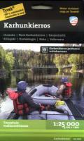
| << Finnland: Wanderkarten vom Calazo Förlag << Calazo Förlag - Schweden - Finnland - Norwegen - Dänemark |
  | |
|
||
Zuletzt angesehene Artikel:
![]() | Bärenrunde Oulanka - Pieni Karhunkierros - Kanjonireitti - Kitkajoki - Kiutaköngäs - Ruka - Valtavaara - Wanderkarte / Bergwanderkarte 1:25.000 - Finnland Karhunkierros Calazo Förlag |
![]() | 5807 Gillenfeld - Wanderkarte mit Wanderwegen (geplottete Ausgabe) ProjektNord - Grundlage Amtliche topographische Karte Landesamt für Vermessung und Geobasisinformation Rheinland-Pfalz |
![]() | P332 Laihia Topographische Karte 1:50.000 EUREF-FIN (Maastokarttat) Maanmittauslaitos / Lantmäteriverket Finnland - ProjektNord |
![]() | 2122 Krempe - Gestern und Heute - Historische Überlagerung 1902-1930 Topographische Landkarte 1:25.000 im Vergleich - Landesvermessungsamt Schleswig-Holstein / ProjektNord |
![]() | 1215 Hörnum (Sylt) - Gestern und Heute - Historische Überlagerung 1932-1950 Topographische Landkarte 1:25.000 im Vergleich - Landesvermessungsamt Schleswig-Holstein / ProjektNord |
![]() | 5708 Kaisersesch - Wanderkarte mit Wanderwegen (geplottete Ausgabe) ProjektNord - Grundlage Amtliche topographische Karte Landesamt für Vermessung und Geobasisinformation Rheinland-Pfalz |
![]() | NL 32-06-01 (2101) Gaschurn Österreichische Karte 1:50.000 mit Wegmarkierungen (topographische Wanderkarte - UTM) - BEV - Österreich |
![]() | Eureka / Arcata / McKinleyville / Crescent City Stadtplan 1:28.000 (Kalifornien - USA) Eureka / Arcata / McKinleyville / Crescent City street map American Automobile Association |
![]() | Radfahren entlang der Atlantikküste (USA) - Radwanderführer (engl.) Florida bis Maine - Donna Ikenberry - THE MOUNTAINEERS Bicycling the Atlantic Coast - A Complete Route Guide, Florida to Maine |
![]() | 7 Kreta 1:200.000 (wasserfeste und reißfeste Landkarte) Landkarte Griechenland -Terrain Cartography - Griechenland - Terrain maps |
![]() | L4306 Dorsten (geplottete Ausgabe) Amtliche topographische Karte 1:50.000 Landesvermessungsamt Nordrhein-Westfalen |
![]() | Frankreich - Belgien - Niederlande Antik - englisch PLANO-Karte 1:1.953 Mio. (Format: 60 x 77 cm) - gerollt im Plastikrohr France - Belgium - Netherlands flat map antique National Geographic |
![]() | NL 33-02-08 (4208) Spital am Pyhrn Österreichische Karte 1:50.000 mit Wegmarkierungen (topographische Wanderkarte - UTM) - BEV - Österreich |
![]() | Osiglia - Bardineto - Murialdo e Bormida - Provincia di Savona (Blatt SV-6) Topographische Wanderkarte 1:25.000 Carta dei Sentieri EdM - Edizioni del Magistero - Italien |
![]() | Heuvelland - Wanderkarte 1:33.333 Noorbeek, Slenaken, Vaals Wandelregiokaart Nederland ANWB - Niederlande |


