| << Schweden: Radwanderkarten von Norstedts - Cykelkartan |
  | |
Zuletzt angesehene Artikel:
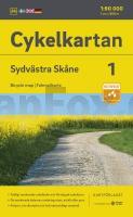
![]() | Cykelkartan Blad 1 Sydvästra Skåne Fahrradkarte Schweden 1:90.000 - Norstedts |
![]() | Edersee, Nationalpark Kellerwald-Edersee Rad- und Wanderkarte mit Ausflugszielen, Einkehr- & Freizeittipps, wetterfest, reissfest, abwischbar, GPS-genau. 1:50000 - von - Freytag-Berndt und ARTARIA PUBLICPRESS |
![]() | 073 N Ã…lfotbreen NORD 1:50.000 - Amtliche Topographische Landkarte Norwegen - Startens Kartverk |
![]() | R758 Radkarte Bodensee 1:75.000 - Rad fahren in Baden-Württemberg - Radwanderkarte Landesvermessungsamt Baden-Württemberg |
![]() | Zypern Landkarte (Blatt 3318) 1:165.000 (wasserfest) AdventureMap wasserfest Cyprus National Geographic |
![]() | United States Highway-Straßenatlas 1:5.3 Mio. USA United States highway atlas Mapping Specialists Ltd |
![]() | 32-412 Topographische Karte 1:25.000 der Tschechischen Republik Zakladnà mapa Ceská republika Cesky urad zememericky a katastralni - ProjektNord |
![]() | 22E COEVORDEN Topographische Karte der Niederlande 1:25.000 (Plotausgabe) 22E COEVORDEN Topografische Kaart van Nederland Kadaster - ProjektNord |
![]() | 3 Leeuwarden Topographische Karte der Niederlande 1:100.000 (Plotausgabe) kadaster - Topografische Dienst / ProjektNord |
![]() | Grenzenlos Wandern 23 abwechslungsreiche Rundtouren in der Eifel und in Luxemburg - J. P. Bachem Verlag |
![]() | 46E HEKKENS Topographische Karte der Niederlande 1:25.000 (Plotausgabe) 46E HEKKENS Topografische Kaart van Nederland Kadaster - ProjektNord |
![]() | 31G WOERDEN Topographische Karte der Niederlande 1:25.000 (Plotausgabe) 31G WOERDEN Topografische Kaart van Nederland Kadaster - ProjektNord |
![]() | 204 N Sørøya NORD 1:50.000 - Amtliche Topographische Landkarte Norwegen - Startens Kartverk |
![]() | Finnland und Nordskandinavien 1:975.000 Landkarte (Blatt 3300) AdventureMap Finnland and Northern Scandinavia National Geographic |
![]() | L3716 Lübbecke (geplottete Ausgabe) Amtliche topographische Karte 1:50.000 Landesvermessungsamt Nordrhein-Westfalen |
![]() | 332.41 Amtliche topographische Karte 1:25.000 Polen |
![]() | 32-243 Topographische Karte 1:25.000 der Tschechischen Republik Zakladnà mapa Ceská republika Cesky urad zememericky a katastralni - ProjektNord |
![]() | Eastern Texas Recreation Map 1:1.013.760 - Landkarte Benchmark Map USA |
![]() | 1 Troisvierges - Houffalize - Clerf 1:40.000 mit Wanderwegen - Wanderkarte Luxemburg - ProjektNord |
![]() | Eifel-Höhen-Route Rundtour um den Nationalpark Eifel. 1:50.000, 230 km, GPS-Tracks Download, Live-Update - Esterbauer |


