| << Belgien: Wanderkarten und Wanderführer << de Rouck Geocart |
  | |
Zuletzt angesehene Artikel:
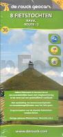
![]() | RAVeL Route 2 (Wallonisch-Brabant) Box mit 8 Radtouren RAVeL Route 2 - 8 Fietstrochten DeRouck - Geocart Belgien |
![]() | Ufa Stadtplan 1:30.000 - Russland Уфа - План города FGUP - Omskaja kartografičeskaja fabrika |
![]() | Costa Rican Spanish Phrasebook - von Thomas Kohnstamm Sprachführer Lonely Planet |
![]() | Mount Mulanje 1:50.000 - Map and Guide EWR - West Col Productions |
![]() | 342.11 Amtliche topographische Karte 1:25.000 Polen |
![]() | 30G ’S-GRAVENHAGE Topographische Karte der Niederlande 1:25.000 (Plotausgabe) 30G ’S-GRAVENHAGE Topografische Kaart van Nederland Kadaster - ProjektNord |
![]() | 3445 Berlin Spandau Topographische Karte 1:25.000 Landesvermessungsamt Brandenburg (gefaltet) |
![]() | 10 COSTA DEL AZAHAR 1:150.000 Touristische Landkarte Spanien - Geo / Estel |
![]() | USA - 1:3.5 Mio. Landkarte Hildebrand`s Urlaubskarten |
![]() | 334.32 Amtliche topographische Karte 1:25.000 Polen |
![]() | Toskana Süd: Florenz - Chianti - Siena - San Gimignano - Maremma 50 Touren - Rother Wanderführer - Bergverlag Rother |
![]() | 019 Gairloch & Ullapool, Loch Maree - Wanderkarte Großbritannien 1:50.000 Active Laminiert LANDRANGER MAP - Ordnance Survey |
![]() | BX25 Duvauchelle Topographische Landkarte Neuseeland 1:50.000 Land Information New Zealand |
![]() | 232 Nuneaton & Tamworth - Wanderkarte Großbritannien 1:25.000 EXPLORER MAP - Active Map LAMINIERT - Ordnance Survey |
![]() | 5420 Schotten Topographische Landkarte Hessen 1:25.000 - ProjektNord (geplottete Ausgabe) |
![]() | Parco Nazionale del Gran Sasso e Monti della Laga (Nr. 2476) - Wanderkarte 1:50.000 4in1 mit Aktiv Guide und Detailkarten inklusive Karte zur offline Verwendung in der KOMPASS-App. Fahrradfahren. - von KOMPASS-Karten GmbH |
![]() | 313.31 Amtliche topographische Karte 1:25.000 Polen |
![]() | 344.4 Amtliche topographische Karte 1:50.000 Polen |
![]() | 34H DEN BRAAM Topographische Karte der Niederlande 1:25.000 (Plotausgabe) 34H DEN BRAAM Topografische Kaart van Nederland Kadaster - ProjektNord |
![]() | 07B BEDUM Topographische Karte der Niederlande 1:25.000 (Plotausgabe) 07B BEDUM Topografische Kaart van Nederland Kadaster - ProjektNord |


