Willkommen bei MapFox
Wurde Ihre Bestellung bestätigt? Wenn nicht - gab es evtl. ein SERVER-Problem! Bitte kontaktieren Sie uns! +++ Buchhändler-Anfragen erwünscht +++
Warenkorb
Artikel: 0 - € 0.00
Zur Kasse
Impressum Kontakt Versandkosten AGB
Belgrad Stadtplan 1:20.000 (serb. / engl.)
Beograd Plan Magic Map Serbien
<< Serbien
<< Magic Map Serbien
 
Cover

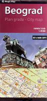
City map of Belgrade in printed form is the latest city map with suburban areas supplemented with all the alterations resulting from the changes that occurred within the city and its wider surroundings. Appropriate choice of colours as well as font type and font size contributed to the map’s modern design and exquisite easy-to-survey quality. Belgrade, with easy-to-survey main roads and important buildings and facilities, is displayed on the cover page, while on the back cover one can find printed: a list of streets with numeric-letter indexes, information on locations and telephone numbers of all important institutions in the city, maps of the suburban areas and a map of "the surrounding area of Belgrade` with marked positions of suburban area maps. New contents made this map excel other maps, thus giving it an additional quality. These new contents, among others, include:

  • City Public Transport lines with marked terminals
  • Information on one way streets in the city
  • Specially designed map with a colourfully displayed layout of "the parking zones`, public parking lots and facilities, location of the car towing service (locally called "spider`), with detailed explanations on the services they provide
  • Detailed maps of a great number of suburban settlements with a wide territory mapping.

Kartenbeispiel

Belgrad Stadtplan 1:20.000 (serb. / engl.)
Beograd Plan Magic Map Serbien
EAN / ISBN: 9788683501533
Preis: EUR 8.90

Fehlt kurzfristig am Lager. - Versandfertig in ca. 1-3 Wochen.
Produkt EUR Anzahl Bestellen
Belgrad Stadtplan 1:20.000 (serb. / engl.)
Beograd Plan Magic Map Serbien
8.90
Versandkostenfrei in Deutschland ab 30,- Bestellwert

incl. MwSt.

Stichworte, die bei der Suche nützlich sein könnten:
Beograd - Belgrad - Magic Map - Serbien - Serbische Landkarten - Serbienkarten - Montenegro - Crna Gora - Srbija - Montenegro Karten - Serbien Karten - Serbien - Serbien Atlanten - Serbien Landkartenverkauf - Serbien Straßenkarten - Serbien Landkarten - Serbien Fahrradkarten - Serbien Karten - Serbien Radwanderführer - Serbien Kartographie - Serbienkarten - Serbien Reiseführer - Serbien Radwanderkarten - Serbien Wanderkarten - Serbien Kartografie - Serbische Karten - Serbische Landkarten

Zuletzt angesehene Artikel:

CoverBelgrad Stadtplan 1:20.000 (serb. / engl.)
Beograd Plan Magic Map Serbien

CoverStolpmünde / Ustka und Umgebung 1:10.000 und 1:45.000 / Rowy i okolice 1:10.000 Landkarte
Ustka i okolice - plan miasta Rowy PLAN Galileos - Polen

Noch kein Cover vorhanden331.14 Amtliche topographische Karte 1:25.000 Polen

CoverLeichte Wanderungen. Wald- und Weinviertel 40 Genusstouren mit GPS-Tracks - von Marcus Stöckl - Bergverlag Rother

Cover25-124 Stary Jicin Topographische Karte 1:25.000 der Tschechischen Republik
Zakladní mapa Ceská republika - Cesky urad zememericky a katastralni - ProjektNord

Noch kein Cover vorhanden253.1 Amtliche topographische Karte 1:50.000 Polen

Cover2609 Emden Amtliche topographische Karte 1:25.000 Landesvermessungsamt Niedersachsen

Noch kein Cover vorhanden029 S Haukeliseter SØR 1:50.000 - Amtliche Topographische Landkarte Norwegen - Startens Kartverk

Cover31/4 Stubaier Alpen Mitte - Wege und Skitouren Wanderkarte Alpenvereinskarte Österreich 1:25.000 - Deutscher Alpenverein

CoverR4243 Pökkö Topographische Karte 1:25.000 EUREF (Peruskartta) Maanmittauslaitos / Lantmäteriverket Finnland - ProjektNord

Cover22-422 Topographische Karte 1:25.000 der Tschechischen Republik
Zakladní mapa Ceská republika Cesky urad zememericky a katastralni - ProjektNord

CoverWandern in Kolmården - Wanderführer schwedisch
Vandra i Kolmården Calazo Förlag Schweden

Cover51H MIERLO Topographische Karte der Niederlande 1:25.000 (Plotausgabe)
51H MIERLO Topografische Kaart van Nederland Kadaster - ProjektNord

Noch kein Cover vorhanden235.12 Amtliche topographische Karte 1:25.000 Polen

Noch kein Cover vorhandenSlesin und Umgebung Touristische Karte 1:50.000 Wanderkarte, Radwanderkarte, Freizeitkarte, Kanurouten
Ślesin i okolice mapa TopMapa Pietruska & Mierkiewicz - Polen

Noch kein Cover vorhanden305.34 Amtliche topographische Karte 1:25.000 Polen

Noch kein Cover vorhanden265.4 Amtliche topographische Karte 1:50.000 Polen

Noch kein Cover vorhanden264.42 Amtliche topographische Karte 1:25.000 Polen

Cover59 Nationalpark Bayerischer Wald 1:35.000 Wanderkarte Fritsch Landkarten-Verlag

Noch kein Cover vorhanden253.32 Amtliche topographische Karte 1:25.000 Polen