| << Spanien: Wanderkarten - EDITORIAL PIOLET << Editorial Piolet s.l. |
||
|
||

Zuletzt angesehene Artikel:
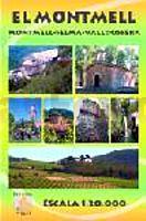
 | EL MONTMELL Wanderkarte 1:20.000 - Editorial Piolet - Spanien |
 | 25115 Napf - Serie Gipfel 1:25.000 Luthern-Bad - Trubschachen - Entlebuch - Topographische Wanderkarte der Schweiz - swisstopo |
 | E09 Forchheim - Hirschaid - Eggolsheim - Buttenheim - Heiligenstadt i. OFr. - Strullendorf - Kirchehrenbach ATK25 Topographische Karte 1:25.000 (Atkis) Bayern Landesvermessungsamt Bayern - Wanderkarte |
 | Camins del Priorat - Priorat Sud Wanderkarte 1:30.000 - Editorial Piolet - Spanien |
 | Pays de l`Emblavez à pied - Réf. P433 Topographischer Wanderführer - FFRP (Fédération française de randonnée pédestre) Frankreich |
 | L5930 Ebern (geplottete Ausgabe) Topographische Karte Bayern 1:50.000 Bayerisches Landesvermessungsamt |
 | Appennino Piacentino 2 - Val Trebbia e Val Nure 1:25.000 - Topographische Wanderkarte mit Infoheft - InfoCartoGrafica Italien |
 | Valdres 1:50.000 Turkart - Wanderkarte Norwegen - Calazo Förlag |
 | Camins del Camp - Costa Nord Wanderkarte 1:25.000 - Editorial Piolet - Spanien |
 | Alta Anoia Nord Calaf - Els Prats de Rei -Pujalt - Sant Pere Sallavinera - Wanderkarte 1:25.000 - Editorial Piolet - Spanien |
 | Oblast Tscheljabinsk - Stadtplan-Atlas 1:15.000 - 1:35.000 Russland Атлас городов челябинской области Navitel - FGUP - Uralaerogeodezija Russland |
 | Amt Eisenach und der Thüringer Wald / Wartburg 1716 - Historische Landkarte Nachdruck Planokarte - gerollt von Homann, J. Baptist - Verlag Rockstuhl |
 | Mit dem Wohnmobil nach Irland (Band 29) Die Anleitung für einen Erlebnisurlaub. Tipps, Tricks, Touren, Tolle Strände. Alle Plätze mit präzisen GPS-Daten - von Uwe Rohland, Annegret Rohland - WOMO-Verlag (Kartoniert) |
 | Suwalki-Land 1:85.000 Laminierte touristische Landkarte Suwalszczyzna ExpressMap Polen |
 | 64 Eggegebirge Süd 1:25.000 Topographische Wanderkarte NRW - Eggegebirgsverein |
 | Eggegebirge Nord Topographische Wanderkarte mit Wanderwegen 1:25.000 - ProjektNord |
 | 7339 Ergoldsbach Topographische Landkarte Bayern 1:25.000 - Normalausgabe - ProjektNord (geplottete Ausgabe) - Grundlage amtliche Topographische Karte Bayern DTK25 |
 | Mit dem Wohnmobil durch die Toskana und nach Elba (Band 8) Wohnmobil, Camping, Reisen, Urlaub - von Ralf Gréus - Womo |
 | DuMont direkt Kanalinseln, Jersey, Guernsey, Alderney, Sark |
 | Eisenbahnkarte Deutschland mit Straßennetz 1865 - Historische Landkarte Nachdruck Planokarte - gerollt - Verlag Rockstuhl |