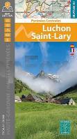
 Ausgezeichnete Wanderkarten für Spanien.  Blattschnitte ALPINA Blattschnitte ALPINA The two maps cover the French territory located north of the Posets-Maladeta Natural Park and, by including the mountain huts on the Spanish side, allow you to plan cross-border hikes through the passes of Benasque, la Glera and la Madera, among others. The signposted paths in the valleys of Luchon, Oô, Louron and Aure (Saint-Lary) link villages, cross forests, bring us to waterfalls and take us to lakes and summits. Little-known areas such as the Pic d`Arbizon,the Lac de Bareilles, Mont Né and the border area with the Val d`Aran have also been mapped. Covered area: Departments of the Haute-Garonne and of the Hautes-Pyrénées, Valleys of Luchon, Louron and Aure (Saint-Lary). Map features: Two topographic maps at a scale of 1:30 000, with information of interest to hikers: mountain huts, marked trails (GR, PR, Local paths), summit ascent routes, access points to hiking areas.
|
Luchon - Saint-Lary - Haute-Garonne - Hautes Pyrénées 1:30.000 Wanderkarte Spanien - ALPINA
EAN / ISBN: 9788470112072
Preis: EUR 19.90
|
|


