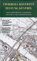
| << Polen: Militärhistorische Landkarten |
  | |
Zuletzt angesehene Artikel:
![]() | Festung Küstrin - Festungs- und Garnisonskarte Landkarte 1:25.000 Twierdza Kostrzyn, Mapa fortyfikacji i garnizonu Pracownia JB72 - Polen |
![]() | Monti Lattari - Penisola Sorrentina - Costiera Amalfitana - Isola di Capri 1:25.000 (Blatt 18) Wanderkarte - Edizioni Il Lupo |
![]() | Karpaten: Bystryzja (Tawpisch - Gropa) Topographische Wanderkarte 1:75.000 Karpaten - Ukraine Карпати. Бистриця (г. Тавпиш - г. Ґропа) Kartografija - ukrmap Ukraine |
![]() | P5444 Rajalampi Topographische Karte 1:25.000 EUREF (Peruskartta) Maanmittauslaitos / Lantmäteriverket Finnland - ProjektNord |
![]() | 2488 Kurken Topographische Karte 1:25.000 Messtischblatt des Deutschen Reiches - Preußische Landesaufnahme / Reichsamt für Landesaufnahme - Faksimile ProjektNord |
![]() | 6231 Adelsdorf Topographische Landkarte Bayern 1:25.000 - Normalausgabe - ProjektNord (geplottete Ausgabe) - Grundlage amtliche Topographische Karte Bayern DTK25 |
![]() | 2550 Brüssow Topographische Karte 1:25.000 Landesvermessungsamt Brandenburg (gefaltet) |
![]() | 3042-SW Topographische Karte 1:10.000 - Landesvermessungsamt Brandenburg |
![]() | Pagosa Springs Bayfield 1:63.360 Colorado (Blatt: 145) Landkarte Trails Illustrated Map National Geographic - USA |
![]() | 09O DEN HELDER (Oost) Topographische Karte der Niederlande 1:50.000 Topografische Dienst (Plotausgabe) |
![]() | N-34-92-A/B Pisz Amtliche topographische Landkarte Polen 1:50.000 N-34-92-A/B Pisz - Mapa Topograficzna Polski Glowny Geodeta Kraju |
![]() | Großes Lautertal, Münsingen - Gomadingen - Zwiefalten - Hayingen Rad- und Wanderkarte mit Ausflugszielen, Einkehr- & Freizeittipps, wetterfest, reißfest, abwischbar, GPS-genau. 1:35000 - von - Freytag-Berndt und ARTARIA PUBLICPRESS |
![]() | Bäder-Dreieck - Innviertel Rad- und Wanderkarte mit Ausflugszielen, Einkehr- und Freizeittipps, Straßennamen und Tourenvoschlägen, reißfest, wetterfest, abwischbar GPS-genau. 1:50000 - von - Freytag-Berndt und ARTARIA PUBLICPRESS |
![]() | 6845 Bayer.Eisenstein Topographische Landkarte Bayern 1:25.000 - Normalausgabe - ProjektNord (geplottete Ausgabe) - Grundlage amtliche Topographische Karte Bayern DTK25 |
![]() | Böhmische und Sächsische Schweiz 1:25.000 (2 Karten im Set) Wanderkarten Czeska i Saksońska Szwajcaria - cz. wschodnia i zachodnia - komplet PLAN Galileos - Polen |
![]() | 0470-1 BATEA Topographische Landkarte 1:25.000 Spanien (Grundlage MTN25) Instituto Geográfico Nacional - CNIG Spanien - ProjektNord |
![]() | El Blanc Infinit - La travesÃa de Groenlandia con esquÃes Literatura Munanya - Editorial Piolet - Spanien |
![]() | Le tour de la Bretagne à vélo (vol.2) Fahrradführer (Spiralbindung) RANDO EDITIONS Par la Côte de Roscoff à Quimperlé (13 étapes) |
![]() | Passau & Passauer Land Mit Rottal und Schärding - von Wolf, Julia - via reise |
![]() | Gotha, Inselsberg und Umgebung - Wander-, Ski- und Radwanderkarte 1:35.000 (Nr. 111) Ausflüge zwischen Ohrdruf, Tambach-Dietharz, Brotterode, Waltershausen und Friedrichsroda. Wander-, Ski- und Radwanderkarte, Alle Radtourenvorschläge m. Entfernungsangaben. Viele Tipps zu Sehenswürdigkeiten. GPS-fähig Dr. Barthel Verlag |


