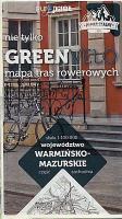
| << Polen: Fahrradkarten und Radwanderführer << Polen: Radwandern: Masuren, Ermland (Ostpreußen), Suwalki-Region << Europilot - Daunpol - Polen |
  | |
Zuletzt angesehene Artikel:
![]() | GreenVelo: Woiwodschaft Ermland-Masuren (Nordwestteil) 1:100.000 Radwanderkarte der Radwege - Steinpapier Woj. warminsko-mazurske cz. północno-zachodnia GreenVelo mapa tras rowerowych (papier skalny) Europilot - Daunpol - Polen |
![]() | Postleitzahlenkarte Deutschland 1:1 Mio. WANDKARTE mit Metallleisten und Aufhängeschnur 67 x 85 cm - Stiefel EUROCART |
![]() | 4223 06 Ylämylly Topographische Karte 1:20.000 (Maastokartta / Peruskartta / Grundkarta) Maanmittauslaitos / Lantmäteriverket Finnland - ProjektNord |
![]() | NL 33-04-08 Ost (3108-Ost) Obertilliach Österreichische Karte 1:25.000 mit Wegmarkierungen (topographische Wanderkarte - UTM) - BEV - Österreich - Vergrößerung (ÖK25V) |
![]() | 4910 Lindlar - Wanderkarte mit Wanderwegen (geplottete Ausgabe) ProjektNord - Grundlage Amtliche topographische Karte 1:25.000 Landesvermessungsamt Nordrhein-Westfalen |
![]() | 4226 Northeim Ost Amtliche topographische Karte 1:25.000 Landesvermessungsamt Niedersachsen |
![]() | 10186 Sørøya Topographische Landkarte 1:50.000 Norge-serien - Nordeca Norwegen |
![]() | Eisenbahnstrecken 1867 - MITTELEUROPA mit DEUTSCHLAND - Historische Landkarte Nachdruck Historische Übersichtskarte Planokarte - (75 x 65 cm - gerollt) - Verlag Rockstuhl |
![]() | 416 Sintra Topographische Landkarte Portugal 1:25.000 Carta Militar de Portugal - Série M889 Instituto Geográfico do Exército (IGeoE) - Portugal |
![]() | SENDER DE LA MEDITERRÀNIA Touristischer Wanderfürher - Wanderkarte 1:50.000 GR 92 Nord - De Portbou (Girona) a Vallvidrera (Barcelona) Editorial Alpina Spanien |
![]() | Krndija (Blatt 7) Topographische Wanderkarte 1:25.000 - Serie Kroatien kontinental Krndija - Serija Kontinentalna Hrvatska - Mountaineering and Hiking map - Croatian Mountain Rescue Service Kroatischer Bergrettungsdienst - Kroatien |
![]() | Maximiliansweg Bayerische Alpen - vom Bodensee zum Königssee. 21 Etappen mit GPS-Tracks - von Andreas Friedrich - Bergverlag Rother |
![]() | 2433 09 Ainali Topographische Karte 1:20.000 (Maastokartta / Peruskartta / Grundkarta) Maanmittauslaitos / Lantmäteriverket Finnland - ProjektNord |
![]() | 4717 Niedersfeld (geplottete Ausgabe) Amtliche topographische Karte 1:25.000 Landesvermessungsamt Nordrhein-Westfalen |
![]() | Marseille CityTrip - Stadtführer Reise-Know-How Verlag |
![]() | Zegrze-Stausee und Umgebung Topographische Wanderkarte Polen 1:50.000 Jezioro Zegrzyńskie i okolice Compass - Polen |
![]() | 1829 Eutin - Gestern und Heute - Historische Überlagerung 1932-1950 Topographische Landkarte 1:25.000 im Vergleich - Landesvermessungsamt Schleswig-Holstein / ProjektNord |
![]() | 1332 10 Petsmo Topographische Karte 1:20.000 (Maastokartta / Peruskartta / Grundkarta) Maanmittauslaitos / Lantmäteriverket Finnland - ProjektNord |
![]() | 606 Chinchón Amtliche topographische Landkarte 1:50.000 Spanien (M.T.N.) 606 Mapa Topográfico Nacional de Espana (MTN50) Instituto Geográfico Nacional - CNIG Spanien |
![]() | Uckermark & Barnim Schorfheide, Templin, Kloster Chorin - von Siegmund, Bernd - via reise |


