| << Polen: Wanderkarten: Pommern, Ostseeküste << EKO-MAP Polen |
  | |
|
||
Zuletzt angesehene Artikel:
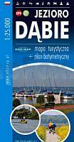
![]() | Dammscher See 1:25.000 Touristische Landkarte, Wanderkarte, Wassersportkarte - Polen Jezioro Dąbie mapa turystyczna + plan batymetryczny GPS 3D EKO-Map - Polen |
![]() | 3211 09 Nisula Topographische Karte 1:20.000 (Maastokartta / Peruskartta / Grundkarta) Maanmittauslaitos / Lantmäteriverket Finnland - ProjektNord |
![]() | Noord-Portugal - Wanderführer (niederländisch) - 25 wandelingen door Porto, Minho, Alto Duro, Tras-os-Montes en Beira Buijten en Schipperheijn |
![]() | Rauma - Pori - Pyhäranta 1:50.000 Wassersportkarte / Bootskarte - Karttakeskus Waterproof map for the coast and archipelago of the Selkämere! Karttakeskus - Finnland |
![]() | 0575-3 ZARZA DE GRANADILLA Topographische Landkarte 1:25.000 Spanien (Grundlage MTN25) Instituto Geográfico Nacional - CNIG Spanien - ProjektNord |
![]() | 610 Cuenca Amtliche topographische Landkarte 1:50.000 Spanien (M.T.N.) 610 Mapa Topográfico Nacional de Espana (MTN50) Instituto Geográfico Nacional - CNIG Spanien |
![]() | 2228 Steinburg - Gestern und Heute - Historische Überlagerung 1953-1956 Topographische Landkarte 1:25.000 im Vergleich - Landesvermessungsamt Schleswig-Holstein / ProjektNord |
![]() | Esfahan Province, General Map of (Blatt 469) 1:300.000 Landkarte Englisch und Persisch نقشه عمومي استان اصفهان Gitashenasi - Iran |
![]() | 361 Cervera Amtliche topographische Landkarte 1:50.000 Spanien (M.T.N.) 361 Mapa Topográfico Nacional de Espana (MTN50) Instituto Geográfico Nacional - CNIG Spanien |
![]() | Tabriz, Complete Map of Greater (Persian & English) 1:15.000 (Blatt 527) Landkarte Englisch und Persisch نقشه شهر تبريز بزرگ Gitashenasi - Iran |
![]() | Herzogtümer Schleswig, Holstein und Lauenburg 1865- Historische Landkarte Nachdruck Planokarte - gerollt - von A.Gräf - Verlag Rockstuhl |
![]() | 468-1 ALBALATE DEL ARZOBISPO Amtliche topographische Landkarte 1:25.000 Spanien (M.T.N.) 468-1 Mapa Topográfico Nacional de Espana (MTN25) Instituto Geográfico Nacional - CNIG Spanien |
![]() | Befestigungsanlagen auf der Halbinsel Hela Militärhistorische Landkarte 1:20.000 Mapa fortyfikacji Polwyspu Helskiego - Map of Hel Peninsula Fortifications Arkadiusz Wozniakowski - Casamata - Polen |
![]() | 2323 03 Nedervetil Topographische Karte 1:20.000 (Maastokartta / Peruskartta / Grundkarta) Maanmittauslaitos / Lantmäteriverket Finnland - ProjektNord |
![]() | Zawidz-Koscielny Topographische Karte 1:25.000 Messtischblatt des Deutschen Reiches - Preußische Landesaufnahme / Reichsamt für Landesaufnahme - Faksimile ProjektNord |
![]() | Gilan Province - Road Map of (Blatt 558) 1:270.000 (Nr. 558) Landkarte Englisch und Persisch نقشه راه هاي استان گيلان Gitashenasi - Iran |
![]() | Slesin und Umgebung Touristische Karte 1:50.000 Wanderkarte, Radwanderkarte, Freizeitkarte, Kanurouten Ślesin i okolice mapa TopMapa Pietruska & Mierkiewicz - Polen |
![]() | 87-1 ELEXALDE Amtliche topographische Landkarte 1:25.000 Spanien (M.T.N.) 87-1 Mapa Topográfico Nacional de Espana (MTN25) Instituto Geográfico Nacional - CNIG Spanien |
![]() | NL 33-02-20 West (4220-West) Oberzeiring Österreichische Karte 1:25.000 mit Wegmarkierungen (topographische Wanderkarte - UTM) - BEV - Österreich - Vergrößerung (ÖK25V) |


