| << Polen: Wassersportkarten und Wassersportführer << Polen: Pommern, Ostseeküste << Polen: Wanderkarten: Pommern, Ostseeküste << EKO-MAP Polen |
  | |
|
||
Zuletzt angesehene Artikel:
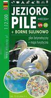
![]() | Pielburger See - Groß Born 1:12.500 Touristische Landkarte, Wassersportkarte mit Tiefenprofilen - Polen Jezioro Pile + Borne Sulinowo - plan batymetryczny + mapa turystyczna | GPS 3D EKO-Map - Polen |
![]() | 3212 02 Vesanka Topographische Karte 1:20.000 (Maastokartta / Peruskartta / Grundkarta) Maanmittauslaitos / Lantmäteriverket Finnland - ProjektNord |
![]() | 2223 Elmshorn - Gestern und Heute - Historische Überlagerung 1953-1956 Topographische Landkarte 1:25.000 im Vergleich - Landesvermessungsamt Schleswig-Holstein / ProjektNord |
![]() | L-34-39-D-d Pahi Amtliche Topographische Karte Ungarn 1:25.000 |
![]() | M-34-137-D-d Istallos-Ko Amtliche Topographische Karte Ungarn 1:25.000 |
![]() | M-34-138-D-d Alsozsolca Amtliche Topographische Karte Ungarn 1:25.000 |
![]() | M-34-20-A-c Amtliche Topographische Karte Ungarn 1:25.000 |
![]() | Theiß 1 (Bustyna / Bustyahaza - Lonya) 1:100.000 Angler,- Wassersportkarte und Fahrradkarte Ungarn Tisza 1. (Bustyaháza-Lónya) vÃzitúratkp. NyÃr-Karta |
![]() | 3332 04 Käänninniemi Topographische Karte 1:20.000 (Maastokartta / Peruskartta / Grundkarta) Maanmittauslaitos / Lantmäteriverket Finnland - ProjektNord |
![]() | M-34-140-B-d Amtliche Topographische Karte Ungarn 1:25.000 |
![]() | 303-4 VILARDEVÓS Amtliche topographische Landkarte 1:25.000 Spanien (M.T.N.) 303-4 Mapa Topográfico Nacional de Espana (MTN25) Instituto Geográfico Nacional - CNIG Spanien |


