| << Russland: Städte, Stadtpläne, Stadtatlanten, Stadtführer << Rus Co. Ltd. |
  | |
|
||
Zuletzt angesehene Artikel:
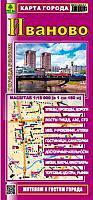
![]() | Iwanowo Stadtplan 1:20.000 - Russland Иваново - Карта города Rus Co. Ltd. |
![]() | Istanbul - touristischer Stadtplan und Reiseführer (türk./engl./dt.) Touristmap Istanbul Harita ve Rehberi Mepmedya Türkei |
![]() | 0395-4 MUGA DE SAYAGO Topographische Landkarte 1:25.000 Spanien (Grundlage MTN25) Instituto Geográfico Nacional - CNIG Spanien - ProjektNord |
![]() | 0926 MENGÍBAR Topographische Landkarte 1:50.000 Spanien (Grundlage MTN50) Instituto Geográfico Nacional - CNIG Spanien - ProjektNord |
![]() | 0961 AZNALCÓLLAR Topographische Landkarte 1:50.000 Spanien (Grundlage MTN50) Instituto Geográfico Nacional - CNIG Spanien - ProjektNord |
![]() | 0416-2 CASTELLDANS Topographische Landkarte 1:25.000 Spanien (Grundlage MTN25) Instituto Geográfico Nacional - CNIG Spanien - ProjektNord |
![]() | 0582-2 PERALES DEL RÍO Topographische Landkarte 1:25.000 Spanien (Grundlage MTN25) Instituto Geográfico Nacional - CNIG Spanien - ProjektNord |
![]() | 0305 CALABOR Topographische Landkarte 1:50.000 Spanien (Grundlage MTN50) Instituto Geográfico Nacional - CNIG Spanien - ProjektNord |
![]() | 0585 ALMONACID DE ZORITA Topographische Landkarte 1:50.000 Spanien (Grundlage MTN50) Instituto Geográfico Nacional - CNIG Spanien - ProjektNord |
![]() | 0653-3 PERALEDA DE SAN ROMÁN Topographische Landkarte 1:25.000 Spanien (Grundlage MTN25) Instituto Geográfico Nacional - CNIG Spanien - ProjektNord |
![]() | 0980-4 SAN SILVESTRE DE GUZMÁN Topographische Landkarte 1:25.000 Spanien (Grundlage MTN25) Instituto Geográfico Nacional - CNIG Spanien - ProjektNord |
![]() | Irland Antik - englisch PLANO-Karte 1:550.000 (Format: 76 x 92 cm) - gerollt im Plastikrohr Ireland flat map antique National Geographic |
![]() | Allgäuer Alpen - Oberstdorf - Sonthofen - Kleinwalsertal - Tannheimer Tal (2 Karten) 1:25.000 (Nr. 003) 25.000 - KOMPASS-Karten |
![]() | 1100-3 COSTA CALMA Topographische Landkarte 1:25.000 Spanien (Grundlage MTN25) Instituto Geográfico Nacional - CNIG Spanien - ProjektNord |
![]() | 0428-3 ATAQUINES Topographische Landkarte 1:25.000 Spanien (Grundlage MTN25) Instituto Geográfico Nacional - CNIG Spanien - ProjektNord |
![]() | 0828-3 BARCARROTA Topographische Landkarte 1:25.000 Spanien (Grundlage MTN25) Instituto Geográfico Nacional - CNIG Spanien - ProjektNord |
![]() | 0943-4 LA CARLOTA Topographische Landkarte 1:25.000 Spanien (Grundlage MTN25) Instituto Geográfico Nacional - CNIG Spanien - ProjektNord |
![]() | Anden - Westliches Südamerika - Straßenkarte 1:3.2 Mio. - Freytag-Berndt und ARTARIA |
![]() | 0896-2 SEGURA DE LEÓN Topographische Landkarte 1:25.000 Spanien (Grundlage MTN25) Instituto Geográfico Nacional - CNIG Spanien - ProjektNord |
![]() | 1036-2 OLVERA Topographische Landkarte 1:25.000 Spanien (Grundlage MTN25) Instituto Geográfico Nacional - CNIG Spanien - ProjektNord |


