| << Russland: Oblaste und Regionen etc. |
||
|
||
Zuletzt angesehene Artikel:
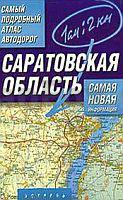
 | Oblast Saratow 1:200.000 / 1:500.000 Autoatlas / Straßenatlas - Russland Самый подробный атлас автодорог. Саратовская область Astrel - Russland |
 | Jüdische Autonome Oblast 1:500.000 Straßenkarte Russland Jewreiskaja awtonomnaja oblast - Karta awtodorog Dal`newostochnyj Federal`nyj Okrug - Russland |
| Irkutsk - Tschita - Ulan Ude - Kjata / Tschita - Zabajkalsk Straßenatlas Russland 1:100.000 Irkutsk - Chita (M-55), Ulan-Ude - Kjata (A-165), Chita - Zabajkalsk (A-166) Atlas avto dorog - Russland |
| Karelien Süd Topografischer Regionalatlas 1:100.000 - Russland (spiral) Atlas Kareija - Juschnaja Tschast AO Roskartografija, AO Novgorodskoe aerogeodezicheskoe predprijatie |
 | Autoatlas Moskau und Umgebung (A5) Moskau Zentrum 1:13.000, Moskau 1:39.000, Großraum Moskau 1:160.000, Oblast Moskau 1:400.000 - Softcover Atlas Print Russland |
 | Tschitinskaja Olbast - Autonomer Kreis der Aginer Burjaten Topographischer Atlas 1:200.000 / 1:500.000 Citinskaja oblastj - Aginskij Burjatskij Avtonomij Okrug - Russland |