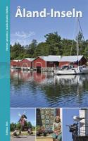
| << Finnland << Edition Elch |
  | |
Zuletzt angesehene Artikel:
![]() | Finnland: Åland-Inseln Reiseführer Heiner Labonde u. Jessika Kuehn-Velten - Edition Elch |
![]() | 7636 Freising Süd Topographische Landkarte Bayern 1:25.000 - Normalausgabe - ProjektNord (geplottete Ausgabe) - Grundlage amtliche Topographische Karte Bayern DTK25 |
![]() | South West Coast Path 1 - Von Minehead nach St. Ives - Wanderkarte 1:40.000 National Trail - HARVEY MAPS South West Coast Path 1 - Minehead to St Ives - National Trail Map |
![]() | Bike Guide Allgäuer Alpen 40 Mountainbike-Touren zwischen Lindau und Füssen. Mit GPS-Tracks - von Baur, StephanBaur, Sebastian - Bergverlag Rother |
![]() | China (Blatt 1 Süd) 1:2 Mio. - geografische Karte CHINA south GiziMap |
![]() | 3631 03 Listimä-Suuas Topographische Karte 1:20.000 (Maastokartta / Peruskartta / Grundkarta) Maanmittauslaitos / Lantmäteriverket Finnland - ProjektNord |
![]() | 1099 Altenkirch Topographische Karte 1:25.000 Messtischblatt des Deutschen Reiches - Preußische Landesaufnahme / Reichsamt für Landesaufnahme - Faksimile ProjektNord |
![]() | 7533 Kühbach Topographische Landkarte Bayern 1:25.000 - Normalausgabe - ProjektNord (geplottete Ausgabe) - Grundlage amtliche Topographische Karte Bayern DTK25 |
![]() | 191 Puente domingo Florez Amtliche topographische Landkarte 1:50.000 Spanien (M.T.N.) 191 Mapa Topográfico Nacional de Espana (MTN50) Instituto Geográfico Nacional - CNIG Spanien |
![]() | 312 Venta de Baños Amtliche topographische Landkarte 1:50.000 Spanien (M.T.N.) 312 Mapa Topográfico Nacional de Espana (MTN50) Instituto Geográfico Nacional - CNIG Spanien |
![]() | 2317-III-NV Topographische Karte Dänemark 1:25.000 Topografisk kort Danmark (DTK/Kort25) 2317-III-NV ProjektNord - Kort & Matrikelstyrelsen / Geodætisk Institut |
![]() | 15G ROTTERDAMSE HOEK Topographische Karte der Niederlande 1:25.000 (Plotausgabe) 15G ROTTERDAMSE HOEK Topografische Kaart van Nederland Kadaster - ProjektNord |
![]() | 2211-IV Tinglev Topographische Karte Dänemark 1:50.000 - Kort & Matrikelstyrelsen ProjektNord |
![]() | Karditsa (Blatt 173) Präfektur Landkarte 1:175.000 Καρδίτσα Orama - Griechenland |
![]() | 113 Salvatierra Agurain Amtliche topographische Landkarte 1:50.000 Spanien (M.T.N.) 113 Mapa Topográfico Nacional de Espana (MTN50) Instituto Geográfico Nacional - CNIG Spanien |
![]() | Auvergne Les 30 plus beaux lacs naturels à pied Wanderführer - (französisch) Chamina - Frankreich |
![]() | 51-d Topographische Landkarte Georgien 1:50.000 Geoland Maps Georgien |
![]() | 2430 Gudow - Gestern und Heute - Historische Überlagerung 1932-1950 Topographische Landkarte 1:25.000 im Vergleich - Landesvermessungsamt Schleswig-Holstein / ProjektNord |
![]() | 5 Aargau Fahrradkarte Schweiz 1:60.000 GPS (wasserfest) Kümmerly & Frey |
![]() | 2311-I Marstal - mit Wanderwegen und Fahrradrouten Topographische Fahrradkarte und Wanderkarte Dänemark 1:50.000 - Kort & Matrikelstyrelsen ProjektNord 2311-I Marstal - Topografisk Cykel- og Vandrekort Danmark |


