| << Deutschland: Historische Karten und Stadtpläne (im Bereich der heutigen Bundesrepublik) << Rockstuhl |
||
|
||
Zuletzt angesehene Artikel:
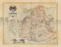
 | Waldeck in Hessen 1635 - Historische Landkarte Nachdruck Planokarte - gerollt von Janssonius - Verlag Rockstuhl |