| << Deutschland: Historische Karten und Stadtpläne (im Bereich der heutigen Bundesrepublik) << Rockstuhl |
  | |
|
||
Zuletzt angesehene Artikel:
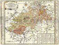
![]() | Vogtland - Neustädtische Kreis und die Ämter Arnshaugk, Miltenfurth, Weyda 1757 - Historische Landkarte Nachdruck Planokarte - gerollt von Schenk, Peter - Verlag Rockstuhl |
![]() | Die 111 schönsten Radtouren in Deutschlands Norden Schleswig-Holstein, Hamburg, Niedersachsen, Nordrhein-Westfalen, Sachsen-Anhalt, Berlin, Brandenburg - BVA BikeMedia |
![]() | 6221 Miltenberg Topographische Landkarte Bayern 1:25.000 - Normalausgabe - ProjektNord (geplottete Ausgabe) - Grundlage amtliche Topographische Karte Bayern DTK25 |
![]() | Oblast Winnyzja 1:250.000 Landkarte, Straßenkarte - Ukraine Vinnytska oblast / Вінницька область Kartografija - ukrmap Ukraine |
![]() | Lykien - Topographische Reisekarte 1:250.000 Türkei (Blatt 7) *** SCHNÄPPCHEN *** mit Wanderwegen und Radwanderwegen - Landkarte ProjektNord |
![]() | 540-4 ORIHUELA DEL TREMEDAL Amtliche topographische Landkarte 1:25.000 Spanien (M.T.N.) 540-4 Mapa Topográfico Nacional de Espana (MTN25) Instituto Geográfico Nacional - CNIG Spanien |
![]() | Oblast Winnyzja 1:250.000 Landkarte, Straßenkarte mit administrativen Grenzen - Ukraine Vinnytska oblast / Вінницька область Kartografija - ukrmap Ukraine |
![]() | 135 Sedano Amtliche topographische Landkarte 1:50.000 Spanien (M.T.N.) 135 Mapa Topográfico Nacional de Espana (MTN50) Instituto Geográfico Nacional - CNIG Spanien |
![]() | 474 La Fregeneda Amtliche topographische Landkarte 1:50.000 Spanien (M.T.N.) 474 Mapa Topográfico Nacional de Espana (MTN50) Instituto Geográfico Nacional - CNIG Spanien |
![]() | 7539 Geisenhausen Topographische Landkarte Bayern 1:25.000 - Normalausgabe - ProjektNord (geplottete Ausgabe) - Grundlage amtliche Topographische Karte Bayern DTK25 |
![]() | Russland, Weißrussland und Ukraine (Blatt 11) - Von Sankt Petersburg bis Odessa und zur Krim - Straßenkarte 1:700.000 Россия Белоруссия Украина - От С.Петербурга до Одессы и Крыма Merkurij |
![]() | 256-I (73-21) Ribes de Freser Amtliche topographische Landkarte 1:25.000 Spanien (M.T.N.) 256-I Mapa Topográfico Nacional de Espana (MTN25) Instituto Geográfico Nacional - CNIG Spanien |
![]() | 353-3 HOYA DE CAMPO ROYO Amtliche topographische Landkarte 1:25.000 Spanien (M.T.N.) 353-3 Mapa Topográfico Nacional de Espana (MTN25) Instituto Geográfico Nacional - CNIG Spanien |
![]() | 682-1 MOHEDAS DE LA JARA Amtliche topographische Landkarte 1:25.000 Spanien (M.T.N.) 682-1 Mapa Topográfico Nacional de Espana (MTN25) Instituto Geográfico Nacional - CNIG Spanien |
![]() | 313 Antigüedad Amtliche topographische Landkarte 1:50.000 Spanien (M.T.N.) 313 Mapa Topográfico Nacional de Espana (MTN50) Instituto Geográfico Nacional - CNIG Spanien |
![]() | Bundeswasserstraßenkarte 1:1 Mio. (*Poster* gerollt - aktuelle Ausgabe) Gliederung der Wasserstraßen- und Schifffahrtsverwaltung des Bundes - Bundesministerium für Digitales und Verkehr |
![]() | 487 Ledanca Amtliche topographische Landkarte 1:50.000 Spanien (M.T.N.) 487 Mapa Topográfico Nacional de Espana (MTN50) Instituto Geográfico Nacional - CNIG Spanien |


