| << Schweden: Wanderführer, Radführer und Reiseführer << Werner Rau Verlag |
  | |
Zuletzt angesehene Artikel:
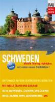
![]() | Mobil Reisen Schweden mit Inseln Öland und Gotland Reiseführer Werner Rau Verlag |
![]() | Bad Ischl - Wolfgangsee XL im Herzen des Salzkammerguts - XL Wanderkarten (Blatt 530) Walter Mayr - KOMPASS |
![]() | 2216-II Hobro - mit Wanderwegen und Fahrradrouten Topographische Fahrradkarte und Wanderkarte Dänemark 1:50.000 - Kort & Matrikelstyrelsen ProjektNord 2216-II Hobro - Topografisk Cykel- og Vandrekort Danmark |
![]() | 14 Canarias occidentales Landkarte 1:500.000 Straßenkarte Spanien - CNIG Centro Nacional de Información Geográfico |
![]() | Touristischer Wanderatlas Tschechien 1:50.000 Turistický Atlas Cesko - SHOCart |
![]() | Chabarowsker Land 1:1 Mio. Topografische Landkarte Habarowskij Kraj Karta Dal`newostochnyj Federal`nyj Okrug - Russland |
![]() | L2522 Harsefeld (geplottete Ausgabe) Topographische Karte 1:50.000 Kartografie Landesvermessungsamt Niedersachsen - ProjektNord |
![]() | 2112-II Løgumkloster Topographische Karte Dänemark 1:50.000 - Kort & Matrikelstyrelsen ProjektNord |
![]() | 8227 Kempten (Allgäu) Topographische Landkarte Bayern 1:25.000 - Normalausgabe - ProjektNord (geplottete Ausgabe) - Grundlage amtliche Topographische Karte Bayern DTK25 |
![]() | 3746 Zossen Sonderausgabe mit Wanderwegen - Topographische Wanderkarte Brandenburg 1:25.000 ProjektNord |
![]() | L2920 Achim (geplottete Ausgabe) Topographische Karte 1:50.000 Kartografie Landesvermessungsamt Niedersachsen - ProjektNord |
![]() | 9 Gavieira (Arcos de Valdevez)- Topographische Landkarte Portugal 1:25.000 Carta Militar de Portugal - Série M888 Instituto Geográfico do Exército (IGeoE) - Portugal |
![]() | Climbing in Athens Δημητρης Τιτοπουλος Αναρριχηση διπλα στο σπιτι σας Anavasi - Griechenland |
![]() | Twer Stadtplan - Oblast Twer Touristenkarte 1:35.000 / 1:800.000 Тверь - Тверская область Rus Co. Ltd. |
![]() | 3248 Melchow Sonderausgabe mit Wanderwegen - Topographische Wanderkarte Brandenburg 1:25.000 ProjektNord |
![]() | Potsdam MM-City - Stadtführer Michael-Müller-Verlag - Reiseführer |
![]() | Fürstentümer Gotha, Coburg, Altenburg 1729 - Historische Landkarte Nachdruck Planokarte - gerollt von Homann - Verlag Rockstuhl |
![]() | 6636 Kastl Topographische Landkarte Bayern 1:25.000 - Normalausgabe - ProjektNord (geplottete Ausgabe) - Grundlage amtliche Topographische Karte Bayern DTK25 |
![]() | Oblast Schytomyr / Schitomir 1:250.000 Landkarte, Straßenkarte mit administrativen Grenzen - Ukraine Schytomyrska oblast / Житомирська область Kartografija - ukrmap Ukraine |
![]() | Island Nordwest Straßenkarte *** SCHNÄPPCHEN *** Generalkarte 1:300.000 Island Mál og menning |


