| << Freeride-Karten und Supertrailkarten << Schweiz: MTB-Karten Single Trail Map 1:50.000 und Supertrail Map 1:50.000 |
  | |
Zuletzt angesehene Artikel:
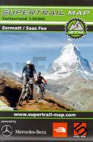
![]() | Zermatt / Saas Fee 1:50.000 - Supertrail Map - Mountainbikekarte - Landkarte outcomm |
![]() | 39 Vrhnika - Topographische Landkarte Slowenien 1:50.000 - Amtliche Kartengrundlage ProjektNord |
![]() | 2414-II-SØ Topographische Karte Dänemark 1:25.000 Topografisk kort Danmark (DTK/Kort25) 2414-II-SØ ProjektNord - Kort & Matrikelstyrelsen / Geodætisk Institut |
![]() | 696 (29-27) Burjassot Amtliche topographische Landkarte 1:50.000 Spanien (M.T.N.) 696 Mapa Topográfico Nacional de Espana (MTN50) Instituto Geográfico Nacional - CNIG Spanien |
![]() | 35 Orust 1:50.000 (wasserfest) Topographische Wanderkarte - Sverigeserien Topo50 - Schweden Kartförlaget |
![]() | 123 - Valongo - Topographische Landkarte Portugal 1:25.000 Carta Militar de Portugal - Série M888 Instituto Geográfico do Exército (IGeoE) - Portugal |
![]() | 892 Amtliche topographische Landkarte 1:50.000 Spanien (M.T.N.) 892 Mapa Topográfico Nacional de Espana (MTN50) Instituto Geográfico Nacional - CNIG Spanien |
![]() | Lyngen (Blatt 18) *** SCHNÄPPCHEN *** Straßenkarte 1:250.000 Norwegen Lyngen Vegkart Norge |
![]() | 0451 LEDESMA Topographische Landkarte 1:50.000 Spanien (Grundlage MTN50) Instituto Geográfico Nacional - CNIG Spanien - ProjektNord |
![]() | 0244-2 RADA Topographische Landkarte 1:25.000 Spanien (Grundlage MTN25) Instituto Geográfico Nacional - CNIG Spanien - ProjektNord |
![]() | 464 (25-18) Used Amtliche topographische Landkarte 1:50.000 Spanien (M.T.N.) 464 Mapa Topográfico Nacional de Espana (MTN50) Instituto Geográfico Nacional - CNIG Spanien |
![]() | Castiglione Chiavarese, Moneglia, Maissana, Varese Ligure, Carro - Provincia di Genova 1:25.000 (Blatt GE-13) Carta dei Sentieri Topographische Wanderkarte 1:25.000 EdM - Edizioni del Magistero - Italien |
![]() | Bergisches Land - Königsforst Topographische Wanderkarte Nordrhein-Westfalen mit Wanderwegen und Radwegen 1:25.000 - ProjektNord |
![]() | 0709 ANCHURAS Topographische Landkarte 1:50.000 Spanien (Grundlage MTN50) Instituto Geográfico Nacional - CNIG Spanien - ProjektNord |
![]() | 363 Aveiras de Cima (Azambuja) Topographische Landkarte Portugal 1:25.000 Carta Militar de Portugal - Série M888 Instituto Geográfico do Exército (IGeoE) - Portugal |
![]() | 6711 Pirmasens Nord - Wanderkarte mit Wanderwegen (geplottete Ausgabe) ProjektNord - Grundlage Amtliche topographische Karte Landesamt für Vermessung und Geobasisinformation Rheinland-Pfalz |
![]() | 6011 Simmern (Hunsrück) - Wanderkarte mit Wanderwegen (geplottete Ausgabe) ProjektNord - Grundlage Amtliche topographische Karte Landesamt für Vermessung und Geobasisinformation Rheinland-Pfalz |
![]() | Forti di Genova - Val Polcevera - Vie del Sale (Blatt GE-10) Topographische Wanderkarte 1:15.000 Carta dei Sentieri EdM - Edizioni del Magistero - Italien |
![]() | 200-4 BURGOS ESTE Amtliche topographische Landkarte 1:25.000 Spanien (M.T.N.) 200-4 Mapa Topográfico Nacional de Espana (MTN25) Instituto Geográfico Nacional - CNIG Spanien |
![]() | 0927-1 BAEZA Topographische Landkarte 1:25.000 Spanien (Grundlage MTN25) Instituto Geográfico Nacional - CNIG Spanien - ProjektNord |


