| << Publicpress - Freytag u Berndt |
  | |
Zuletzt angesehene Artikel:
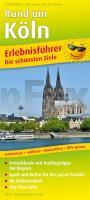
![]() | Rund um Köln Erlebnisführer mit City-Plan Köln, Informationen zu Freizeiteinrichtungen auf der Kartenrückseite, wetterfest, reißfest, GPS-genau. 1:150000 - von - Freytag-Berndt und ARTARIA PUBLICPRESS |
![]() | 035 Kingussie and Monadhliath Mountains - Wanderkarte Großbritannien 1:50.000 LANDRANGER MAP - Ordnance Survey |
![]() | 211 (30-10) Boltana Amtliche topographische Landkarte 1:50.000 Spanien (M.T.N.) 211 Mapa Topográfico Nacional de Espana (MTN50) Instituto Geográfico Nacional - CNIG Spanien |
![]() | 3149-SO Topographische Karte 1:10.000 - Landesvermessungsamt Brandenburg |
![]() | 441.33 Amtliche topographische Karte 1:25.000 Polen |
![]() | 3127SB Cuiseaux - Montpont-en-Bresse - GPS Amtliche Topographische Wanderkarte Frankreich 1:25.000 - série bleue (IGN) |
![]() | W524 Sevettijärvi Topographische Karte 1:50.000 EUREF-FIN (Maastokarttat) Maanmittauslaitos / Lantmäteriverket Finnland - ProjektNord |
![]() | Kolnica Topographische Karte 1:25.000 Messtischblatt des Deutschen Reiches - Preußische Landesaufnahme / Reichsamt für Landesaufnahme - Faksimile ProjektNord |
![]() | 3134 Arendsee (Altmark) Topographische Karte 1:25.000 Landesamt für Vermessung und Geoinformation Sachsen-Anhalt (Landesvermessungsamt) |
![]() | 8034 Starnberg Süd Topographische Landkarte Bayern 1:25.000 - Normalausgabe - ProjektNord (geplottete Ausgabe) - Grundlage amtliche Topographische Karte Bayern DTK25 |
![]() | L1948 Wolgast Amtliche Topographische Karte 1:50.000 Landesvermessungsamt Mecklenburg-Vorpommern |
![]() | 2223 03 Jääskänjärvi Topographische Karte 1:20.000 (Maastokartta / Peruskartta / Grundkarta) Maanmittauslaitos / Lantmäteriverket Finnland - ProjektNord |
![]() | 6608 Illingen Topographische Karte 1:25.000 - Landesvermessungsamt Saarland |
![]() | Konin plus 3 Stadtplan - Kolo - Slupca - Turek 1:15.000 - DEMART Polen |
![]() | 8727 Biberkopf Topographische Landkarte Bayern 1:25.000 - Normalausgabe - ProjektNord (geplottete Ausgabe) - Grundlage amtliche Topographische Karte Bayern DTK25 |
![]() | Königreich SACHSEN im Deutschen Reich um 1905 - Historische Landkarte Nachdruck Planokarte - gerollt - Verlag Rockstuhl |
![]() | 39-546 Pfälzerwald 1 - Homburg, Hornbach, Pirmasens, Zweibrücken 1:25.000 - Wanderkarte mit Radwegen - NaturNavi |
![]() | 379 Dunkeld - Aberfeldy & Glen Almond - Wanderkarte Großbritannien 1:25.000 EXPLORER MAP - Ordnance Survey |
![]() | 106 Newquay & Padstow - Wanderkarte Großbritannien 1:25.000 EXPLORER MAP - Ordnance Survey |
![]() | O10 Starnberg - mit Gauting, Germering, Gilching, Seefeld, Herrsching a.Ammersee ATK25 Topographische Karte 1:25.000 (Atkis) Bayern Landesvermessungsamt Bayern - Wanderkarte |


