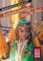
| << Reise-Know-How Verlag - world mapping project << Reisen allgemein: Fremdsprachen, Verständigung und Kultur |
  | |
Zuletzt angesehene Artikel:
![]() | Aserbaidschanisch - Wort für Wort Kauderwelsch-Sprachführer (Band 214) Aserbaidschan - Reise-Know-How Verlag |
![]() | 4908 Burscheid (geplottete Ausgabe) Amtliche topographische Karte 1:25.000 Landesvermessungsamt Nordrhein-Westfalen |
![]() | Ausbildung Erste Hilfe für Wanderer und Bergsteiger - SAC-Verlag Schweizer Alpen-Club |
![]() | Kittlitz (Sächs.) Reichenbach i. d. Oberlausitz (Preuss.) Topographische Karte 1:25.000 Messtischblatt des Deutschen Reiches - Preußische Landesaufnahme / Reichsamt für Landesaufnahme - Faksimile ProjektNord |
![]() | Falk Stadtplan Extra Standardfaltung Osnabrück + Umgebungskarte Mit Ortsteilen von Belm, Bissendorf, Georgsmarienhütte, Hasbergen |
![]() | Walking the Gran Paradiso National Park Wanderführer - Cicerone (englisch) |
![]() | Roskilde & Nationalpark Skjoldungernes Land 1:30.000 - Calazo Outdoormaps Serie - Calazo Förlag Dänemark |
![]() | 1378 Hela Topographische Karte 1:25.000 Messtischblatt des Deutschen Reiches - Preußische Landesaufnahme / Reichsamt für Landesaufnahme - Faksimile ProjektNord |
![]() | 4020 Blomberg (geplottete Ausgabe) Amtliche topographische Karte 1:25.000 Landesvermessungsamt Nordrhein-Westfalen |
![]() | Parque Natural de Somiedo 1:25.000 / 1:50.000 Cordillera Cantabrica - Parque Natural de Somiedo 1:30.000/60.000 EDICIONES ADRADOS Parque Natural de Somiedo Babia y Laciana Norte |
![]() | Erläuterungen zur Geologischen Karte 5140 Meerane-Crimmitschau (93) - Ausgabe 1904 Sächsisches Landesamt für Umwelt, Landwirtschaft und Geologie |
![]() | 7745 Rotthalmünster Süd Topographische Landkarte Bayern 1:25.000 - Normalausgabe - ProjektNord (geplottete Ausgabe) - Grundlage amtliche Topographische Karte Bayern DTK25 |
![]() | JURA (Blatt D39) Département-Landkarte Frankreich 1:100.000 JURA - Carte départementale - IGN Frankreich |
![]() | Jekaterinburg Stadtplan 1:20.000 - Uralskaja Kartografitscheskaja Kompanija - Russland |
![]() | Bayern (Süd) 1:275.000 Regionale Straßenkarte (Blatt 8) München - Oberbayern - Kümmerly & Frey |
![]() | M5424 Punkaharju Topographische Karte 1:25.000 EUREF (Peruskartta) Maanmittauslaitos / Lantmäteriverket Finnland - ProjektNord |
![]() | Polen Straßenkarte 1:750.000 - laminiert Polska - Laminowana mapa drogowa Daunpol - Polen |
![]() | ÎLE-DE-FRANCE EST - PARIS - SEINE-SAINT-DENIS - VAL-DE-MARNE - SEINE-ET-MARNE (Blatt D75 - D77 - D91 - D93 - D94) Département-Landkarte Frankreich 1:100.000 - Carte départementale - IGN Frankreich |
![]() | Ireland Whiskey Puzzle 1.000 Teile Format 48 x 68 cm |
![]() | M5143 Mietinsaari Topographische Karte 1:25.000 EUREF (Peruskartta) Maanmittauslaitos / Lantmäteriverket Finnland - ProjektNord |


