| << USA: Wanderkarten, Nationalpark-Karten << Hildebrand`s Urlaubskarten |
||
|
||
Zuletzt angesehene Artikel:
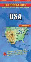
 | USA - 1:3.5 Mio. Landkarte Hildebrand`s Urlaubskarten |
 | Lugansk Stadtplan 1:25.000 Luhansk plan goroda Kartografija - ukrmap Ukraine |
 | V43 Topographische Karte 1:100.000 EUREF-FIN Maanmittauslaitos / Lantmäteriverket Finnland - ProjektNord |
 | 019 Gairloch & Ullapool, Loch Maree - Wanderkarte Großbritannien 1:50.000 Active Laminiert LANDRANGER MAP - Ordnance Survey |
 | BX25 Duvauchelle Topographische Landkarte Neuseeland 1:50.000 Land Information New Zealand |
 | N12: Agdz - Zagora - Vallée du Drâa - 1:120.000 + GPS-Waypoints - Marokko Touristische Karte - www.marokko-erfahren.de - Kartographie Huber |
 | 5815 Wehen Topographische Landkarte Hessen 1:25.000 - ProjektNord (geplottete Ausgabe) |
 | L5140 Altenburg Topographische Karte Thüringen 1:50.000 Landesvermessungsamt Thüringen |
 | Allgäu 2: Ostallgäu und Lechtal *** SCHNÄPPCHEN *** - Rother Wanderführer - Bergverlag Rother |
 | 07B BEDUM Topographische Karte der Niederlande 1:25.000 (Plotausgabe) 07B BEDUM Topografische Kaart van Nederland Kadaster - ProjektNord |
 | Kanufahren in Yukon - McQuest River - Stewart River McQuest Lake bis zum Klondike Highway - McQuest Lake bis Mayo - von Bernhard Allgeyer und Berthold Baumann - Allgeyer Verlag |
 | N-34-100-C/D Zuromin Amtliche topographische Landkarte Polen 1:50.000 N-34-100-C/D Zuromin - Mapa Topograficzna Polski Glowny Geodeta Kraju |
 | 417 Monadhliath Mountains North & Strathdearn - Wanderkarte Großbritannien 1:25.000 EXPLORER MAP - Ordnance Survey |
 | 45A HEDEL Topographische Karte der Niederlande 1:25.000 (Plotausgabe) 45A HEDEL Topografische Kaart van Nederland Kadaster - ProjektNord |
 | Eiland van Dordrecht, Biesbosch - Wanderkarte 1:33.333 Wandelregiokaart Nederland ANWB - Niederlande |
 | Hanse-Radweg 1:75.000, 450 km, wetterfest/reißfest, GPS-Tracks Download, LiveUpdate - Esterbauer |
 | 03H EEMSHAVEN Topographische Karte der Niederlande 1:25.000 (Plotausgabe) 03H EEMSHAVEN Topografische Kaart van Nederland Kadaster - ProjektNord |
 | Sentier de l`Ardenne GR14 . De l´Eifel aux Ardennes françaises Topo-Guide du Sentier de Grande Randonnée - Belgien (französisch) GRSentiers - Grote Routepaden |
| Entdeckungsreisen - Östliche Hemisphäre (Europa - Afrika - Asien - Australien) PLANO-Karte (Format: 51 x 46 cm) - gerollt im Plastikrohr Eastern Hemisphere flat map map of discovery National Geographic |
 | Midi Toulouseain Pyrénnées - Gers - LeGuideVert - Grüner Reiseführer (französisch) - Michelin |