 MÄNGELEXEMPLAR - Altauflage 2005, daher zum Sonderpreis. Wasserfeste Landkarte, GPS-tauglich. Islas Canarias, La Gomera, Playa de las Américas, Puerto de la Cruz, Santa Cruz de Tenerife, Time Zone (BerndtsonMAP) (Road Map/ Landkarte) [Folded Map/ Faltkarte] BerndtsonMAP is a watersafe, durable, laminated and easy to fold road map. The BerndtsonMAP features overview and detail maps with elaborate road and street network, points of interest, public facilities, hotels, shopping centers and markets, including a time zone map as well as useful statistics, temperature, weight and measurement conversion charts, climate charts with temperatures, sunshine hours, precipitation and humidity. Special feature of the BerndtsonMAP is a selection of the 15 most popular POIs (points of interest) shown in a LocatorMAP and with short text description including opening hours and useful web-sites.  Klicken Sie hier, wenn Sie diesen Artikel in der Version zum normalen Preis sehen möchten. Klicken Sie hier, wenn Sie diesen Artikel in der Version zum normalen Preis sehen möchten.
Kartenausschnitt
Kartenbeispiel
|
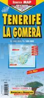
Tenerife & La Gomera 1:100.000 / 1:140.000 *** SCHNÄPPCHEN *** Straßenkarte Berndtson
EAN / ISBN: 9783866095649
Preis: EUR 3.00
|
|


