Willkommen bei MapFox
Wurde Ihre Bestellung bestätigt? Wenn nicht - gab es evtl. ein SERVER-Problem! Bitte kontaktieren Sie uns! +++ Buchhändler-Anfragen erwünscht +++
Warenkorb
Artikel: 0 - € 0.00
Zur Kasse
Impressum Kontakt Versandkosten AGB
Ireland 1:700.000 Straßenkarte Berndtson
<< Irland
<< Berndtson
 
Cover

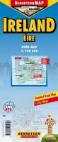
Wasserfeste Landkarte, GPS-tauglich.

Cork, Dublin, Dublin+, Wicklow Mountains, Time Zone (BerndtsonMAP) (Road Map/ Landkarte) [Folded Map/ Faltkarte]

BerndtsonMAP is a watersafe, durable, laminated and easy to fold road map. The BerndtsonMAP features overview and detail maps with elaborate road and street network, points of interest, public facilities, hotels, shopping centers and markets, including a time zone map as well as useful statistics, temperature, weight and measurement conversion charts, climate charts with temperatures, sunshine hours, precipitation and humidity. Special feature of the BerndtsonMAP is a selection of the 15 most popular POIs (points of interest) shown in a LocatorMAP and with short text description including opening hours and useful web-sites.

Kartenausschnitt

Kartenbeispiel

Ireland 1:700.000 Straßenkarte Berndtson
EAN / ISBN: 9783865925626
Preis: EUR 9.90

Bestellartikel: versandfertig in ca. 3-7 Tagen. Dieser Artikel wird speziell für Sie bestellt. Keine Rücknahme!
Produkt EUR Anzahl Bestellen
Ireland 1:700.000 Straßenkarte Berndtson 9.90
Versandkostenfrei in Deutschland ab 30,- Bestellwert

incl. MwSt.

Stichworte, die bei der Suche nützlich sein könnten:
Irland - Ireland - Irland Landkarte - Berndtson - Berndtson & Berndtson - Berndson - Berndtson Landkarten - Berndtson Länderkarten - Berndtson Stadtpläne - Berndtson Citypläne - Berndtson City-Pläne - Berndtson maps - Berndtson city maps - Irland Landkarten - Ireland road maps - Irland

Zuletzt angesehene Artikel:

CoverIreland 1:700.000 Straßenkarte Berndtson

CoverWalking the Gran Paradiso National Park Wanderführer - Cicerone (englisch)

CoverNamibia The premier guidebook for Business Globetrotters (englisch)
Namibia eBiz Guides

CoverPoitou Straßenkarte Local 1:150.000 (Blatt 322) Michelin Frankreich

CoverLanguedoc-Roussillon Regionale Straßenkarte 1:200.000 (Blatt 526) Michelin Frankreich

CoverCycle Touring in France Eight selected cycle tours - Radwanderführer Cicerone Großbritannien (englisch)

CoverDolomiten 3: Gadertal - Von Bruneck bis Corvara 55 Touren - Rother Wanderführer - Bergverlag Rother

CoverKönigreich Tonga Landkarte - ITMB International Travel Maps (engl.)
Tonga Islands

CoverStadtplan Andijon / Andischan
Andijon viloyati - Usbekistan

Cover077 Adamello Sud - Val Rendena - Val Daone Topographische Wanderkarte 1:25.000 Casa Editrice Tabacco - Italien

CoverSchottland 1:370.000 (wasserfest) Landkarten - ITMB International Travel Reference Maps (engl.)
Scotland

CoverWalks and Scrambles in the Moroccan Anti-Atlas Bergwanderführer/ Wanderführer - Cicerone (englisch)