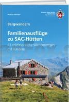
| << Schweizer Alpen Club SAC |
  | |
Zuletzt angesehene Artikel:
![]() | Familienausflüge zu SAC-Hütten von Heidi Schwaiger - SAC-Verlag Schweizer Alpen-Club |
![]() | 264 Vale of Clwyd / Dyffryn Clwyd - Wanderkarte Großbritannien 1:25.000 EXPLORER MAP - Active Map LAMINIERT - Ordnance Survey |
![]() | Il Cammino di Santiago de Compostela Teil 1 - 1:50.000 - da Saint-Jean-de-Port a León - Wanderkartenatlas - Geo4 Map - Italien |
![]() | Kleine Fatra 1:50.000 (Blatt 5010) Wanderkarte (slowakische Version) Malá Fatra TatraPlan - Slowakei |
![]() | Menschen am Berg Geschichten vom Leben ganz oben - von Melanie Mühl - Malik National Geographic |
![]() | 348 Campsie Fells - laminierte Wanderkarte Großbritannien 1:25.000 EXPLORER MAP - Ordnance Survey |
![]() | Fahrradkarte Gera - Altenburg - Zwickau 1:75.000 - Grünes Herz |
![]() | L4340 Gräfenhainichen 1:50.000 Amtliche Topografische Wanderkarte - Landesvermessungsamt Sachsen-Anhalt |
![]() | 466 Shetland - Mainland South - laminierte Wanderkarte Großbritannien 1:25.000 EXPLORER MAP - Ordnance Survey |
![]() | 2147 Medow Amtliche Topographische Karte 1:25.000 Landesvermessungsamt Mecklenburg-Vorpommern |
![]() | Monte Fitz Roy - Cerro Torre 1:50.000 - Lago del Desierto 1:100.000 Argentinien / Chile ZAGIER & URRUTY PUBLICATIONS |
![]() | 2135 Zurow Amtliche Topographische Karte 1:25.000 Landesvermessungsamt Mecklenburg-Vorpommern |
![]() | 226 Kleine Fatra - Große Fatra Touristische Landkarte Slowakei 1:100.000 - SHOCart Mala Fatra, Velka Fatra |
![]() | 1447 Sassnitz Amtliche Topographische Karte 1:25.000 Landesvermessungsamt Mecklenburg-Vorpommern |
![]() | 1642 Barth Amtliche Topographische Karte 1:25.000 Landesvermessungsamt Mecklenburg-Vorpommern |
![]() | 351 Dunbar & North Berwick - laminierte Wanderkarte Großbritannien 1:25.000 EXPLORER MAP - Ordnance Survey |
![]() | Gettorf - Wittensee Topographische Wanderkarte mit Wanderwegen und Radwegen 1:25.000 Schleswig-Holstein - ProjektNord |
![]() | 10088 Smøla Topographische Landkarte 1:50.000 Norge-serien - Nordeca Norwegen |
![]() | 7813 Emmendingen Topographische Landkarte 1:25.000 - Landesvermessungsamt Baden-Württemberg |
![]() | 1937 Hanstorf Amtliche Topographische Karte 1:25.000 Landesvermessungsamt Mecklenburg-Vorpommern |


