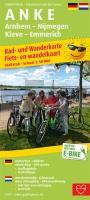
| << Publicpress - Freytag u Berndt |
  | |
Zuletzt angesehene Artikel:
![]() | A N K E, Arnhem - Nijmegen - Kleve - Emmerich Rad- und Wanderkarte/Fiets- en wandelkaart mit Ausflugszielen, Einkehr- & Freizeittipps, wetterfest, reissfest, abwischbar, GPS-genau. 1:50000 - von - Freytag-Berndt und ARTARIA Publicpress |
![]() | 7132 Dollnstein Topographische Landkarte Bayern 1:25.000 - Normalausgabe - ProjektNord (geplottete Ausgabe) - Grundlage amtliche Topographische Karte Bayern DTK25 |
![]() | 3242 06 Vakkakuusi Topographische Karte 1:20.000 (Maastokartta / Peruskartta / Grundkarta) Maanmittauslaitos / Lantmäteriverket Finnland - ProjektNord |
![]() | 0780-3 PANTANO DEL ZÚJAR Topographische Landkarte 1:25.000 Spanien (Grundlage MTN25) Instituto Geográfico Nacional - CNIG Spanien - ProjektNord |
![]() | Weltkarte für Kinder, 1:20.000.000, gefaltet, freytag & berndt 137,5 x 96 cm, Rekorde der Welt, illustrierte Kinderweltkarte - von freytag & berndt - Freytag-Berndt und ARTARIA |
![]() | 821-3 Alcoy / Alcoi Amtliche topographische Landkarte 1:25.000 Spanien (M.T.N.) 821-3 Mapa Topográfico Nacional de Espana (MTN25) Instituto Geográfico Nacional - CNIG Spanien |
![]() | Erläuterungen zur Geologischen Karte 5144 Augustusburg-Flöha (97) - Ausgabe 1905 Sächsisches Landesamt für Umwelt, Landwirtschaft und Geologie |
![]() | 2316-III - mit Wanderwegen und Fahrradrouten Topographische Fahrradkarte und Wanderkarte Dänemark 1:50.000 - Kort & Matrikelstyrelsen ProjektNord 2316-III - Topografisk Cykel- og Vandrekort Danmark |
![]() | 7328 Wittislingen Topographische Landkarte Bayern 1:25.000 - Normalausgabe - ProjektNord (geplottete Ausgabe) - Grundlage amtliche Topographische Karte Bayern DTK25 |
![]() | 34 Torrelavega Amtliche topographische Landkarte 1:50.000 Spanien (M.T.N.) 34 Mapa Topográfico Nacional de Espana (MTN50) Instituto Geográfico Nacional - CNIG Spanien |
![]() | 101-4 MURIAS DE PAREDES Amtliche topographische Landkarte 1:25.000 Spanien (M.T.N.) 101-4 Mapa Topográfico Nacional de Espana (MTN25) Instituto Geográfico Nacional - CNIG Spanien |
![]() | 216 (35-10) Bellver de Cerdanya Amtliche topographische Landkarte 1:50.000 Spanien (M.T.N.) 216 Mapa Topográfico Nacional de Espana (MTN50) Instituto Geográfico Nacional - CNIG Spanien |
![]() | Balkangebirge - Balkan Mountain map No 7 - Daskotna village to Cape Emine (International tourist route E3) Topographische Wanderkarte 1:50.000 - Bulgarien - Wasserfest - Oilaripi Bulgarien Stara Planina No. 7 / Стара планина № 7 - село Дъскотна - нос Емине |
![]() | Tschita - Chabarowsk - Wladiwostok Straßenatlas Russland 1:100.000 Chita - Habarovsk (M-58) Habarovsk - Vladivostok (M-60) Atlas avto dorog - Russland |
![]() | 821 (29-32) Alcoy / Alcoi Amtliche topographische Landkarte 1:50.000 Spanien (M.T.N.) 821 Mapa Topográfico Nacional de Espana (MTN50) Instituto Geográfico Nacional - CNIG Spanien |


