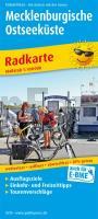
| << Publicpress - Freytag u Berndt |
  | |
Zuletzt angesehene Artikel:
![]() | Mecklenburgische Ostseeküste Radkarte mit Ausflugszielen, Einkehr- & Freizeittipps, wetterfest, reissfest, abwischbar, GPS-genau. 1:100000 - von - Freytag-Berndt und ARTARIA Publicpress |
![]() | 10 Straumnes Topographische Karte Island 1:100.000 - Ferdakort 10 STRAUMNES - Atlaskort - Ferðakort |
![]() | 3744-SO Topographische Karte 1:10.000 - Landesvermessungsamt Brandenburg |
![]() | 138 - Topographische Landkarte Portugal 1:25.000 Carta Militar de Portugal - Série M888 Instituto Geográfico do Exército (IGeoE) - Portugal |
![]() | CC 8734 Rosenheim Bodenübersichtskarte 1:200.000 - Bundesanstalt für Geowissenschaften und Rohstoffe (BGR) |
![]() | Hochland von Wielun - Zaleczanski-Landschaftspark Touristische Landkarte 1:60.000 Wanderkarte / Landkarte Wyżyna Wieluńska - Załęczański Park Krajobrazowy mapa turystyczna - wodoodporna PLAN Galileos - Polen |
![]() | 311 Saksunardalur Färöer - Topographische Karte 1:20.000 311 Færøer - Topografisk kort 1:20.000 - Miliøministeriet - Kort & Matrikelstyrelsen / ProjektNord |
![]() | 102 Los Barrios de Luna Amtliche topographische Landkarte 1:50.000 Spanien (M.T.N.) 102 Mapa Topográfico Nacional de Espana (MTN50) Instituto Geográfico Nacional - CNIG Spanien |
![]() | 345 - Topographische Landkarte Portugal 1:25.000 Carta Militar de Portugal - Série M888 Instituto Geográfico do Exército (IGeoE) - Portugal |
![]() | Japan (Süd) & Railway & Road 1:670.000 wasserfeste Landkarte - ITMB International Travel Reference Maps (engl.) Japan South |
![]() | Kreis Kleve *POSTER* Topographische Kreiskarte 1:50.000 - Format: ca. 91 x 126 cm - ProjektNord |
![]() | 4250 Vetschau / Spreewald Sonderausgabe mit Wanderwegen - Topographische Wanderkarte Brandenburg 1:25.000 ProjektNord |
![]() | 02-23-05 Topographische Karte 1:10.000 der Tschechischen Republik Zakladnà mapa Ceská republika - Cesky urad zememericky a katastralni - ProjektNord |
![]() | Bug-Durchbruch in Podlachien 1:50.000 - Touristische Landkarte und Wanderkarte Polen Podlaski Przełom Bugu Agencja TD - Polen |
![]() | Upernavik (Blatt 6) 1:500.000 VIKING Polar Cruise Series Topographische Landkarte Saga Maps Grönland |
![]() | L7140 Straubing *** SCHNÄPPCHEN *** Topographische Karte Bayern 1:50.000 Bayerisches Landesvermessungsamt |
![]() | Erläuterungen zur Geologischen Karte 5150 Rosenthal-Hoher Schneeberg (103) - Ausgabe 1888 Sächsisches Landesamt für Umwelt, Landwirtschaft und Geologie |
![]() | 2943 Rheinsberg - Charlottenau Sonderausgabe mit Wanderwegen - Topographische Wanderkarte Brandenburg 1:25.000 ProjektNord |
![]() | 317 Ballantrae - Barr and Barrhill - Wanderkarte Großbritannien 1:25.000 EXPLORER MAP - Active Map LAMINIERT - Ordnance Survey |
![]() | U4143 Venejärvi Topographische Karte 1:25.000 EUREF (Peruskartta) Maanmittauslaitos / Lantmäteriverket Finnland - ProjektNord |


