 Der Tourismusverband NÃķrdlicher Schwarzwald bezeichnet die eigene Region als ein `Urlaubsparadies, wie es in Deutschland nur wenige gibt`. Der ErlebnisfÞhrer bestÃĪtigt diese EinschÃĪtzung: Weit Þber 100 touristische Attraktionen bereichern hier den Urlaub. Der Europapark Rust, die begehbare Kuckucksuhr bei Schonach, Gleitschirmfliegen in Baiersbronn, das Kurhaus in Baden-Baden sind hier nur exemplarisch genannt. Weitere Infos gibt es gut zusammengestellt auf der RÞckseite.
|
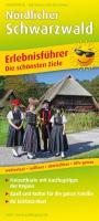
NÃķrdlicher Schwarzwald ErlebnisfÞhrer mit Informationen zu Freizeiteinrichtungen auf der KartenrÞckseite, wetterfest, reiÃfest,abwischbar, GPS-genau. 1:150000 - von - Freytag-Berndt und ARTARIA PUBLICPRESS
EAN / ISBN: 9783747300244
Preis: EUR 8.90
|
|


