| << Freytag & Berndt |
  | |
Zuletzt angesehene Artikel:
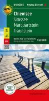
![]() | Chiemsee, Wander-, Rad- und Freizeitkarte 1:50.000, freytag & berndt, WK D5203 Simssee - Marquartstein - Traunstein, GPX Tracks, wasserfest und reißfest - von freytag & berndt - Freytag-Berndt und ARTARIA |
![]() | Historische Übersichtskarte: DEUTSCHES REICH - Ostpreußen, Westpreußen, Posen, Schlesien nach Versailler Vertrag 1919 (Reprint PLANO) - Verlag Rockstuhl |
![]() | Dels Pirineus al Massis del Port GR7 incl 15 Wanderkarten-Ausschnitten Wanderführer Spanien - ALPINA |
![]() | R-36-097/098 1:100.000 - Amtliche Topographische Karte der Russischen Föderation (Sowjetische Militärkarte) |
![]() | Zakopane und Tatra-Vorland Touristischer Führer (polnisch) Zakopane Wycieczki w Tatry przewodnik PLAN Galileos - Polen |
![]() | Midi-Pyrénées - Reiseführer von Annette Meisser - Michael-Müller-Verlag |
![]() | Zakopane und Polnische Tatra 1:11.000/1:40.000 Wanderkarte, Radwanderkarte, Freizeitkarte Zakopane i Tatry Polskie Wydawnictwo Gauss |
![]() | Porto CityTrip Reiseführer mit Faltplan und kostenloser Web-App - von Petra Sparrer - Reise Know-How |
![]() | 3243 12 Pouhansaari Topographische Karte 1:20.000 (Maastokartta / Peruskartta / Grundkarta) Maanmittauslaitos / Lantmäteriverket Finnland - ProjektNord |
![]() | 37 Okoli Prahy vychod Wanderkarte Tschechien 1:50.000 - KCT - Papierausgabe 37 Okoli Prahy vychod |
![]() | Frankreich Départements - puzzle magnets (französisch) 100 Teile - City Puzzle Extragoods |
![]() | Oberbayern, Motorradkarte 1:250.000, freytag & berndt Tirol - Südtirol, Toureninfos, GPX Tracks, wasserfest und reißfest - von freytag & berndt - Freytag-Berndt und ARTARIA |
![]() | Tatra - slowakischer und polnischer Teil Touristische Landkarte 1:55.000 Wanderkarte, Radwanderkarte, Freizeitkarte Tatry Polskie i Słowackie mapa ExpressMap - Polen |
![]() | Luban Stadtplan und Touristische Landkarte 1:17.000 / 1:75.000 Wanderkarte, Freizeitkarte Luboń - plan miasta TopMapa Pietruska & Mierkiewicz - Polen |
![]() | 592 Bordeira (Aljezur) Topographische Landkarte Portugal 1:25.000 Carta Militar de Portugal - Série M889 Instituto Geográfico do Exército (IGeoE) - Portugal |
![]() | L3540 Brandenburg an der Havel Topographische Karte 1:50.000 (Regelblattschnitt) Landesvermessungsamt Brandenburg |
![]() | Provinz Brandenburg 1863 - Historische Landkarte Nachdruck Planokarte - gerollt - von Adolf Gräf - Verlag Rockstuhl |
![]() | Pfalz Erlebnisführer mit Informationen zu Freizeiteinrichtungen auf der Kartenrückseite, wetterfest, reißfest, abwischbar, GPS-genau. 1:160000 - von - Freytag-Berndt und ARTARIA PUBLICPRESS |
![]() | Nordalbanien Wanderkarte - Thethi und Kelmend (englische Ausgabe) 1:50.000 - Kartographie Huber Hiking map - NORTHERN ALBANIA - Thethi - Kelmendi - With 50 signposted hikes. |
![]() | Köln Nordwest Topographische Wanderkarte Nordrhein-Westfalen mit Wanderwegen und Radwegen 1:25.000 - ProjektNord |


