| << Freytag & Berndt |
  | |
Zuletzt angesehene Artikel:
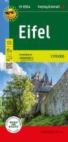
![]() | Eifel Freizeitkarte mit touristischen Infos auf Rückseite, wasserfest und reißfest - von freytag & berndt - Freytag-Berndt und ARTARIA |
![]() | 4350 Altdöbern Topographische Karte 1:25.000 Landesvermessungsamt Brandenburg (gefaltet) |
![]() | Europa Organisations-Karte Plano 1:3.600.000 97 x 119 cm - Stiefel EUROCART |
![]() | 511 Gøta - Färöer - Topographische Karte 1:20.000 511 Færøer - Topografisk kort 1:20.000 - Miliøministeriet - Kort & Matrikelstyrelsen / ProjektNord |
![]() | L-34-III Eger Amtliche Topographische Landkarte Ungarn 1:200.000 |
![]() | Bike map 3 - L`Alto Appennino Reggiano 1:25.000 MTB-Fahrradkarte GEOMEDIA - Italien |
![]() | Erläuterungen zur Geologischen Karte 4752 Welka-Lippitsch (38) - Ausgabe 1891 Sächsisches Landesamt für Umwelt, Landwirtschaft und Geologie |
![]() | Deutsche Ostsee (West) - Großraumkarte 1:250.000 - POSTER Topographische Landkarte ca. 90 x 80 cm Bundesamt für Kartographie und Geodäsie - ProjektNord |
![]() | Historische Karte: EUROPA im September 1940 (gerollt) Planokarte - gerollt - Verlag Rockstuhl |
![]() | 6714 Edenkoben Topographische Karte 1:25.000 - Landesamt für Vermessung und Geobasisinformation Rheinland-Pfalz |
![]() | 5902 Dasburg Topographische Karte 1:25.000 - Landesamt für Vermessung und Geobasisinformation Rheinland-Pfalz |
![]() | 211 Ervedal da Beira (Oliveira do Hospital) Topographische Landkarte Wanderkarte und Fahrradkarte Portugal 1:25.000 211 Mapa topográfico - Mapa de caminhadas - Portugal 1:25.000 ProjektNord |
![]() | Eisenbahnen Deutschlands 1862/63 - Historische Landkarte Nachdruck Planokarte - gerollt von Hartmann, W. - Verlag Rockstuhl |
![]() | HH1 Radwanderkarte Lauenburgische Seen - Sachsenwald *** RESTEXEMPLAR *** 1:75.000 mit Tourenbeschreibungen - ProjektNord |
![]() | Europe rail map 1:500.000-1.5 Mio Eisenbahnkarte - HarperCollins |
![]() | Erläuterungen zur Geologischen Karte 4949 Dresden Ost - Ausgabe 2018 Sächsisches Landesamt für Umwelt, Landwirtschaft und Geologie |
![]() | Erläuterungen zur Geologischen Karte 4839 Pegau-Predel n. Hemmendorf (41/57) - Ausgabe 1921 Sächsisches Landesamt für Umwelt, Landwirtschaft und Geologie |
![]() | 600 Vila Real de Santo António Topographische Landkarte Wanderkarte und Fahrradkarte Portugal 1:25.000 600 Mapa topográfico - Mapa de caminhadas - Portugal 1:25.000 ProjektNord |
![]() | el Montnegre i el Corredor (Blatt 69) 1:25.000 Alt Maresme, Baix Montseny - Wanderkarte Katalonien (Spanien) - Col·lecció Unitats Geogràfiques - Institut Cartogràfic de Catalunya |
![]() | L3312 Quakenbrück Amtliche topographische Karte 1:50.000 Landesvermessungsamt Niedersachsen |


