| << Schweiz: Topographische Landeskarten Swisstopo 1:25.000 mit Zusammensetzungen (Landkarten) |
  | |
Zuletzt angesehene Artikel:
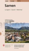
![]() | 25018 Sarnen 1:25.000 - Lungern - Giswil - Melchtal - Topographische Landeskarte der Schweiz - Hauptorte - swisstopo |
![]() | 22-31 Topographische Karte 1:50.000 der Tschechischen Republik Zakladnà mapa Ceská republika - Cesky urad zememericky a katastralni - ProjektNord |
![]() | Gratwandern Schweiz - 64 Panorama-Touren der Extraklasse zwischen Genfersee und Bodensee - Mit GPS-Daten - Bergverlag Rother |
![]() | Schaffhausen - Hochrhein - Klettgau - Randen - Reiat - Hegau. 60 Touren. Mit GPS-Daten - Bergverlag Rother |
![]() | 3242 Königshorst Topographische Karte 1:25.000 Landesvermessungsamt Brandenburg (gefaltet) |
![]() | 109 Bodmin Moor - Bodmin, Camelford & Liskeard - Wanderkarte Großbritannien 1:25.000 EXPLORER MAP - Active Map LAMINIERT - Ordnance Survey |
![]() | Mardi Himal Trek 1:50.000 - Annapurna Conservation Area - Trekking Map - Nepal Map Publisher Pvt. Ltd. |
![]() | 482.23/P Poniatów (Peucker) Amtliche topographische Karte 1:25.000 Polen |
![]() | 274.23 Amtliche topographische Karte 1:25.000 Polen |
![]() | P5413 Nunnanlahti Topographische Karte 1:25.000 EUREF (Peruskartta) Maanmittauslaitos / Lantmäteriverket Finnland - ProjektNord |
![]() | 235.33 Amtliche topographische Karte 1:25.000 Polen |
![]() | Stubaier Alpen 1:50.000 (Blatt 83) - Wanderkarte mit Broschüre KOMPASS |
![]() | 22-43 Vodnany Topographische Karte 1:50.000 der Tschechischen Republik Zakladnà mapa Ceská republika - Cesky urad zememericky a katastralni - ProjektNord |
![]() | Bad Tusnad und Umgebung (Blatt 7) - topographische Wanderkarte 1:25.000 (wasserfeste Karte, rum.-ung.) Baile Tusnad si imprejurimile Harta turistica / Tourist map Zenith - Rumänien |
![]() | 264.34 Amtliche topographische Karte 1:25.000 Polen |
![]() | 154.42 Baranow Sandomierski Amtliche topographische Karte 1:25.000 Polen |
![]() | Montana Touristische Landkarte 1:800.000 (Montana - USA) Montana Easy to Read State Map GM Johnson |
![]() | 25 S-Hertogenbosch Topographische Karte der Niederlande 1:100.000 (Plotausgabe) kadaster - Topografische Dienst / ProjektNord |
![]() | 02-234 Decin Topographische Karte 1:25.000 der Tschechischen Republik Zakladnà mapa Ceská republika - Cesky urad zememericky a katastralni - ProjektNord |
![]() | 6: Mikkeli - Lappeenranta Topographische Straßenkarte und Radwanderkarte Finnland 1:250.000 - ProjektNord |


