Willkommen bei MapFox
Wurde Ihre Bestellung bestätigt? Wenn nicht - gab es evtl. ein SERVER-Problem! Bitte kontaktieren Sie uns! +++ Buchhändler-Anfragen erwünscht +++
Warenkorb
Artikel: 0 - € 0.00
Zur Kasse
Impressum Kontakt Versandkosten AGB
Italie - Voyage en train 1:1.550 Mio. Landkarte Cartotrain
<< Italien
<< Reisen allgemein: Eisenbahn
 
Cover

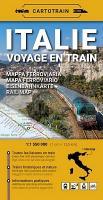
Übersichtskarte der Eisenbahnlinien in Italien.

ITALY - TRAIN TRAVEL

Does Italy appeal to you? Explore the riches of the peninsula by train!

The cradle of Roman civilization also has an excellent rail network! Less than a year after the success of the map of France, CARTOTRAIN is back with the fold-out paper map for train travel in Italy:

- nearly 3.000 stations, even on clifftops or in the heart of historic towns,
- 15.000 kilometers of track covering the entire country from Sicily to the Alps,
- a wide selection of historic and tourist trains, rapidly expanding in Italy

Night train map

Rules for train + bike travel

Journey time map

Detailed station index

Historic trains

Italie - Voyage en train 1:1.550 Mio. Landkarte Cartotrain
EAN / ISBN: 9782959394492
Preis: EUR 14.90

Bestellartikel: versandfertig in ca. 3-7 Tagen. Dieser Artikel wird speziell für Sie bestellt. Keine Rücknahme!
Produkt EUR Anzahl Bestellen
Italie - Voyage en train 1:1.550 Mio. Landkarte Cartotrain 14.90
Versandkostenfrei in Deutschland ab 30,- Bestellwert

incl. MwSt.

Stichworte, die bei der Suche nützlich sein könnten:
Frankreich Eisenbahnkarte - Französische Eisenbahnen Landkarte - Italien - Italien Landkarten - Italienische Wanderkarten - Italienische Landkarten - Italienkarten - Italien Reiseführer - Italy Italia - Italien Wandern - Italien Autokarten - Italien Straßenkarten - Italy maps - Italian maps - Italian hiking maps - Eisenbahn-Landkarten

Zuletzt angesehene Artikel:

CoverItalie - Voyage en train 1:1.550 Mio. Landkarte Cartotrain

CoverMoseltal - vom Dreiländereck bis Koblenz - Reiseführer von Katja Nolles - Reise Know-How Verlag

CoverPerm Stadtplan 1:33.300 - Russland
Пермь Rus Co. Ltd.

Noch kein Cover vorhandenAmerican Highway Road Atlas (A4) Straßenatlas - ITMB International Travel Maps (engl.)

CoverMillstätter See (Nr. 066) 1:25.000 - Wanderkarte KOMPASS

CoverGrönland 1:1.9 Mio. Landkarte Reiß- und wasserfest - world mapping project Reise Know-How

Cover6 Valpelline - Saint-Barthelemy 1:25.000 Topographische Wanderkarte l`Escursionista Editore - Italien

Cover42/3-4 DALHEM - HERVE NGI 1:25.000 Topographische Landkarte Belgien

Cover224 Corby - Kettering & Wellingborough - Wanderkarte Großbritannien 1:25.000 EXPLORER MAP - Ordnance Survey

CoverAthen Stadtplan 1:12.000 -1:23.000
ATHENS - Internationale Stadtpläne Cartographia

Cover30 Eastbourne & Beachy Head Wanderkarte 1:25.000 Großbritannien AA Automobile Association / OS Ordnance Survey Großbritannien

CoverKatalonien Straßenkarte Spanien 1:300.000
Catalogne IGN

Cover175 Southend-on-Sea & Basildon - Wanderkarte Großbritannien 1:25.000 EXPLORER MAP - Ordnance Survey

Cover1048 RHEINFELDEN 1:25.000 - Schopfheim - Möhlin - Wehr - Topographische Landeskarte der Schweiz - swisstopo

CoverSpanien auf dem Motorrad entdecken - Motorrad Reiseführer Touristik-Verlag Vellmar

CoverWalking the Coast to coast Walk 1:25.000 (Northern England) Map Booklet - Cicerone Großbritannien (englisch)

Cover26 Lough Allen - Wanderkarte Nord-Irland 1:50.000 DISCOVERER MAP - Ordnance Survey

CoverÖsterreich Postleitzahlenkarte - Magnetmarkiertafel 1:500.000 freytag & berndt

Cover22 GENT NGI 1:50.000 Topographische Karte Belgien

Cover01 Dorset South & Purbeck Wanderkarte 1:50.000 Großbritannien AA Automobile Association / OS Ordnance Survey Großbritannien